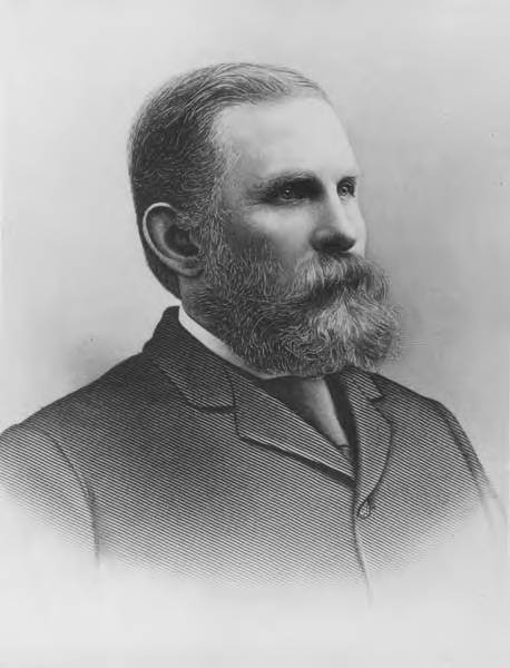
This street is named for Dexter Horton (1825–1904). Born in Seneca Lake, New York, he was living in Princeton, Illinois before he came west in 1852 with, among others, Thomas Mercer and Daniel and Clarence Bagley. He and Mercer came to Seattle in 1853. In 1870, he founded the city’s first bank, the Dexter Horton Bank. (It later merged with Seattle National Bank and First National Bank to form the First Seattle Dexter Horton National Bank, which unwieldy name became First National Bank of Seattle, then Seattle-First National Bank, and eventually Seafirst, the name it used from 1974 until the brand was retired in favor of Bank of America in 1999. (Bank of America had bought Seafirst in 1983.)
Dexter Horton
Dexter Avenue begins just south of Denny Way at 7th Avenue and becomes Dexter Avenue N north of Denny. From there it goes 2 miles north, then northwest, to the intersection of Westlake Avenue N, 4th Avenue N, and Nickerson Street, just south of the Fremont Bridge.
This street is named after Charles Carroll Terry (1830–1867), one of the members, along with his older brother, Lee, of the Denny Party that landed at Alki Point in November 1851. Shortly after the landing, he opened the first store in King County. Lee had made a land claim in Alki a few months earlier, but went home to New York the next year; Charles remained, even after most of the other settlers left for what is now Pioneer Square. It seems he finally moved north in 1857, trading his Alki land for that of David Swinson “Doc” Maynard in Pioneer Square. He died 10 years later, according to this biography, of tuberculosis. (Whether or not he and his brother were responsible for naming the Alki Point settlement New York, which became New York–Alki [the latter word meaning ‘by and by’ or ‘someday’ in Chinook Jargon] and then just Alki, is unclear, although he did officially apply the Alki name to the town plat he filed in 1853.)
Terry Avenue begins at Alder Street on First Hill and goes ½ a mile to Spring Street, where it is blocked by Virginia Mason Hospital. Resuming at Seneca Street, it goes ⅕ of a mile to Pike Street. On the other side of Interstate 5 and the Washington State Convention Center, it begins again at Howell Street and goes ⅘ of a mile to Valley Street and Lake Union Park, becoming Terry Avenue N as it crosses Denny Way. Amazon.com’s headquarters are at 410 Terry Avenue N, between Harrison Street and Republican Street.
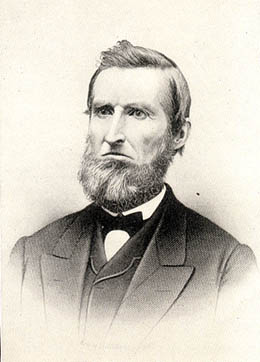
This street is named for Judge Edward Lander (1816–1907), chief justice of the territorial supreme court from 1853 to 1857. In 1855, he, along with Charles Terry, bought Carson Boren’s downtown land claim for $500. They subsequently donated two acres of land, along with Arthur Denny, who donated eight, to form the first campus of the University of Washington, which opened in 1861. The university owns the Metropolitan Tract to this day, though it moved to its present location in 1895. Lander’s name also appears on Lander Hall, a UW dormitory on NE Campus Parkway.
Edward Lander
SW Lander Street begins at 59th Avenue SW in the Alki neighborhood of West Seattle, and goes ⅕ of a mile to 55th Avenue SW. It resumes just to the south at S Lander Place and goes a further ⅛ of a mile to SW Admiral Way. Picking up again at 50th Avenue SW, it makes it ½ a mile to Walnut Avenue SW before being interrupted again, as happens to so many West Seattle streets because of the varying topography. There is a final ¼-mile stretch in West Seattle from 39th Avenue SW to 36th Avenue SW, then a very short segment on Harbor Island before S Lander Street resumes in the Industrial District at Colorado Avenue S and goes ¾ of a mile east to Airport Way S. On Beacon Hill, Lander begins just west of 13th Avenue S and goes ⅔ of a mile to just past 23rd Avenue S, including the block-long stretch that is now known as S Roberto Maestas Festival Street. Lander begins again at 30th Avenue S in Mount Baker and goes a final four blocks to 34th Avenue S.
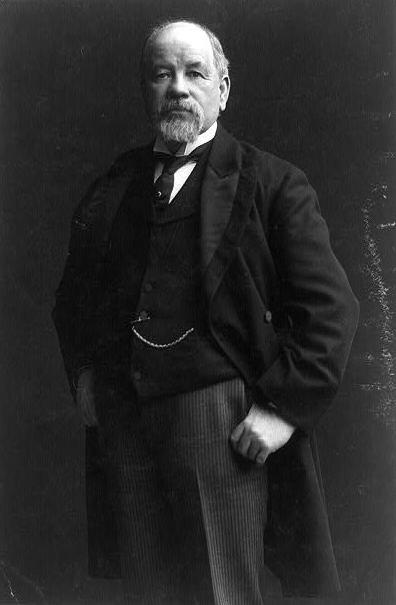
This street is named for Dr. Thomas Taylor Minor (1844–1889), who came to Seattle in 1883 from Port Townsend, where he had lived since 1868 and whose mayor he had been in 1880 and 1881. He was one of the founders of the Seattle, Lake Shore and Eastern Railway in 1885 and became mayor of Seattle from 1887 to 1889. He drowned off Whidbey Island while on a duck-hunting trip on December 2, 1889. The other fatalities were George Morris Haller, brother of Theodore Haller for whom Haller Lake is named, and his brother-in-law, Lewis Cox.
Dr. Thomas Taylor Minor
Minor Avenue begins at Broadway just north of Jefferson Street and goes ⅔ of a mile northwest to Pine Street. Resuming on the other side of Interstate 5 at Olive Way, it goes another ⅔ of a mile northwest, then north, to Mercer Street, having become Minor Avenue N north of Denny Way. After a two-block stretch from Roy Street to Aloha Street, it appears again as Minor Avenue E at E Newton Street, and goes nearly ½ a mile to its end at E Roanoke Street.
This alley, which runs from NE 45th Street to NE 47th Street between 7th Avenue NE and 8th Avenue NE, adjacent to the Blue Moon Tavern, was named in 1995 for poet Theodore Huebner Roethke (1908–1963). A professor of English at the University of Washington from 1947 to 1963, Roethke won the Pulitzer Prize for Poetry in 1954, the National Book Award for Poetry in 1959 and (posthumously) 1965, and the Bollingen Prize for Poetry in 1959. His best-known poem may be “The Waking,” which begins:
I wake to sleep, and take my waking slow. I feel my fate in what I cannot fear. I learn by going where I have to go.
The Seattle Times says the resolution naming the alley “notes [Roethke] conducted numerous ‘symposia formal and informal in the Blue Moon Tavern and celebrated his receipt of both the Pulitzer and Bollingen prizes at the Blue Moon.’” The full text of the resolution is not available online, but I wonder if it specifically calls out the reason for Roethke Mews as opposed to Roethke Alley; as Knute Berger notes for Crosscut, it’s “a great pun on ‘muse’ if nothing else.”
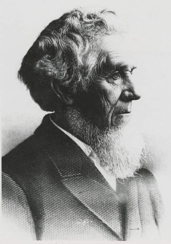
This street is named for Edward Hanford (1807–1884) and his wife, Abigail Jane Holgate (1824–1905), who left Iowa in the early 1850s to settle adjacent to Abigail’s brother, John (namesake of S Holgate Street), on what is today known as Beacon Hill but was known from then until the early 1890s as Holgate and Hanford Hill. Edward and his family were loggers, then orchardists, and unlike John Holgate, he went on to develop his donation claim.
The Hanfords’ son Clarence (1857–1920) founded, with James D. Lowman, the Lowman & Hanford Stationery and Printing Company in 1885. The firm went out of business in the 1960s, but their Pioneer Square building still, the last time I drove by, had a sign painted on it reading “Seattle’s Oldest Retail Company,” which it very well might have been when it closed. Their son Thaddeus (1847–1892) was for a time the owner of the Daily Intelligencer newspaper, predecessor of the Seattle Post-Intelligencer. And their son Cornelius (1849–1926), a federal judge from 1890 to 1912, was earlier a territorial legislator, Seattle city attorney, and chief justice of the Washington Supreme Court. He is the namesake of Hanford, Washington, and by extension the Hanford Site, which produced the plutonium used in the first nuclear explosion and the bombing of Nagasaki. He was also the author of Seattle and Environs, 1852-1924.
Edward Hanford
SW Hanford Street begins in West Seattle at SW Admiral Way and 59th Avenue SW and goes ¼ mile east to Schmitz Preserve Park at 56th Avenue SW. It begins again at 51st Avenue SW and goes nearly a mile east to 36th Avenue SW, becoming a stairway for the half-block east of 46th Avenue SW. After serving as little more than a driveway between SW Admiral Way and Fauntleroy Avenue SW, it next appears as S Hanford Street at E Marginal Way S, where it goes for ⅓ of a mile east to Occidental Avenue S. After a few short segments farther east in the Industrial District, Hanford begins again on Beacon Hill at 12th Avenue S and goes nearly a mile east to Rainier Avenue S, the segment between 25th Avenue S and Morse Avenue S being a stairway. It resumes a few blocks east at 30th Avenue S and finishes up ½ a mile east at Cascadia Avenue S.
This street is named for John Cornelius Holgate (1828–1868). Born in Ohio, he took the Oregon Trail west in 1847 and explored Elliott Bay and the Duwamish River by canoe in the summer of 1850. (The Seattle Times calls him “the first non-Indian of record to have done so.”) He returned to Oregon afterwards, however, and did not settle in what is now Seattle — specifically, Beacon Hill — until 1853, two years after the Denny Party landed at Alki Point. His mother, Elizabeth; brothers, Lemuel and Milton; and sister, Abigail, along with her husband, Edward Hanford (namesakes of S Hanford Street), soon followed. The Hanfords settled on the hill — known thereafter as Holgate and Hanford Hill until the late 1880s — adjacent to Holgate. (Milton was one of three whites to die in the Battle of Seattle in 1856, and was himself the cause of one of those deaths, having earlier shot Jack Drew, a deserting sailor from the USS Decatur, in a “friendly-fire” incident.)
A gold prospector, Holgate left for Idaho in 1863, and died there in 1868, the first casualty of the War Under the Mountain, a conflict between two rival gold mines in the Owyhee Desert, one of which he was part owner. According to Robert L. Deen, writing for True West magazine, there are conflicting accounts of Holgate’s death. The Owyhee Avalanche reported that:
Desperate fighting ensued during the charge…. John C. Holgate… one of the foremost in the advance, was shot in the head, and must have died instantaneously.
The Idaho Tri-Weekly Statesman had a slightly different story:
It appears that J.C. Holgate has been killed, some say assassinated, murdered — not killed in a fight, but shot through the head without provocation.
SW Holgate Street begins in West Seattle just west of 47th Avenue SW and goes ¼ of a mile east to California Avenue SW at Palm Avenue SW. There are two more short segments on the peninsula, between 41st Avenue SW and Arch Avenue SW and between Victoria Avenue SW and Brook Avenue SW. S Holgate Street resumes at Utah Avenue S and goes ¾ of a mile east to an overpass over Interstate 5, where it becomes Beacon Avenue S. There is a one-block stretch between 12th Avenue S and 13th Avenue S on top of the hill, and then Holgate goes a mile from the Beacon Hill Playfield at 14th Avenue S to 31st Avenue S at Colman Park, the half-block east of 16th Avenue S being a stairway and the block between 28th Avenue S and 29th Avenue S being unimproved. There is finally a short stretch east of Lakeside Avenue S at 36th Avenue S that essentially serves as a private driveway; it is a shoreline street end, but one not yet accessible to the public.
This street was named in 1895 for George Kinnear (1836–1912), the namesake of nearby Kinnear Park. Born in Ohio, he grew up first in Indiana, then Illinois. He fought for the Union during the Civil War and came to Seattle in 1878, his brother, John, following a few years later. During the time of anti-Chinese agitation, he was captain of the Home Guard that enforced the rule of law and prevented those who wished to expel Chinese laborers from doing so violently. His account of the events of February 1886 was published in the Seattle Post-Intelligencer in 1911 as “Anti-Chinese Riots at Seattle, Wn., February 8th, 1886.”
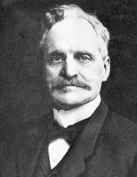
This Ballard street is named for Boyd J. Tallman (1858–1932), who became a superior court judge in 1900. Originally from Pennsylvania, Tallman came to Walla Walla in 1885 and moved to Seattle two years later. That same year, he, along with Thomas Burke, William Rankin Ballard, and John Leary, founded the West Coast Improvement Company, which filed the plat of Gilman Park in 1889. Almost all of the street names were changed when Ballard was annexed to Seattle in 1907, but five streets that paralleled the Salmon Bay shoreline and one that ran perpendicular to it, as opposed to following the cardinal directions, were left alone: Shilshole Avenue, Ballard Avenue, Leary Avenue, Tallman Avenue, Barnes Avenue, and Ione Place.
Judge Boyd J. Tallman
Tallman Avenue NW goes ⅕ of a mile from NW Market Street just east of 20th Avenue NW to 17th Avenue NW just south of NW 52nd Street and NW Ione Place.
This street, originally named Columbian Way in the 1920 plat of Victory Heights, was given its current name sometime during or before 1936, the first time I find it mentioned in the archives of The Seattle Times. I presume this was to avoid confusion with the Columbian Way in South Seattle, even though Victory Heights wasn’t annexed to Seattle until 1953.
The plat was filed by the Goodwin Real Estate Company and the Squire Investment Company. The Goodwin Real Estate Company at that time had Ervin Shirley Goodwin (1869–1937) as its president and his nephew, Arthur Eliot Goodwin (1887–1960), as its secretary. (Ervin and his brothers were instrumental in the development of Pike Place Market.) I presume the renaming was to honor Erwin rather than Arthur, though explicit explanations are rarely given for street naming. It may very well have been to honor the company. (Incidentally, Erwin’s wife, Eda, was a founder of the Seattle Fruit and Flower Mission in 1907; this organization became the Seattle Milk Fund in 1935 and Goodwin Connections in 2019.)
Ervin Shirley Goodwin
Unfortunately, in addition to being major developers (in addition to Victory Heights, they were behind Lakeridge, Hawthorne Hills, and subdivisions in Northgate, Lake City, and Windermere), the Goodwin Real Estate Company were pioneers in imposing racial restrictive covenants on their developments. As the Seattle Civil Rights & Labor History Project writes,
Seattle’s first known racial restrictive covenant was written in 1924 by the Goodwin Company and applied to three tracts of land and one block of the company’s development in the Victory Heights neighborhood in north Seattle.
It read:
Said tract shall not be sold, leased, or rented to any person or persons other than of Caucasian race nor shall any person or persons other than of Caucasian race use or occupy said tract.
Goodwin Way NE begins at 19th Avenue NE just north of NE Northgate Way and goes ¼ mile northwest to 15th Avenue NE between NE 113th Street and NE 115th Street.
This street, and the park through which it runs, were named for John Melancthon Frink (1855–1914). Born in Pennsylvania but raised in Kansas, he came to Seattle in 1874. At various times he was a teacher, businessman, school board director, city councilman, and state senator. Frink became a parks commissioner in 1906, the same year he bought Washington Park (not to be confused with the park of the same name to the north) and donated it to the city, which renamed it after him. Frink Place was established in 1927; there had been an earlier Frink Boulevard, but it, like University Boulevard, Stixrud Drive, and Blaine Boulevard, among others, had become part of Lake Washington Boulevard by 1920.
John Melancthon Frink
S Frink Place begins at S Washington Street just east of 32nd Avenue S, and goes ⅙ of a mile through the park to the intersection of S Jackson Street, 34th Avenue S, and Lake Washington Boulevard S.
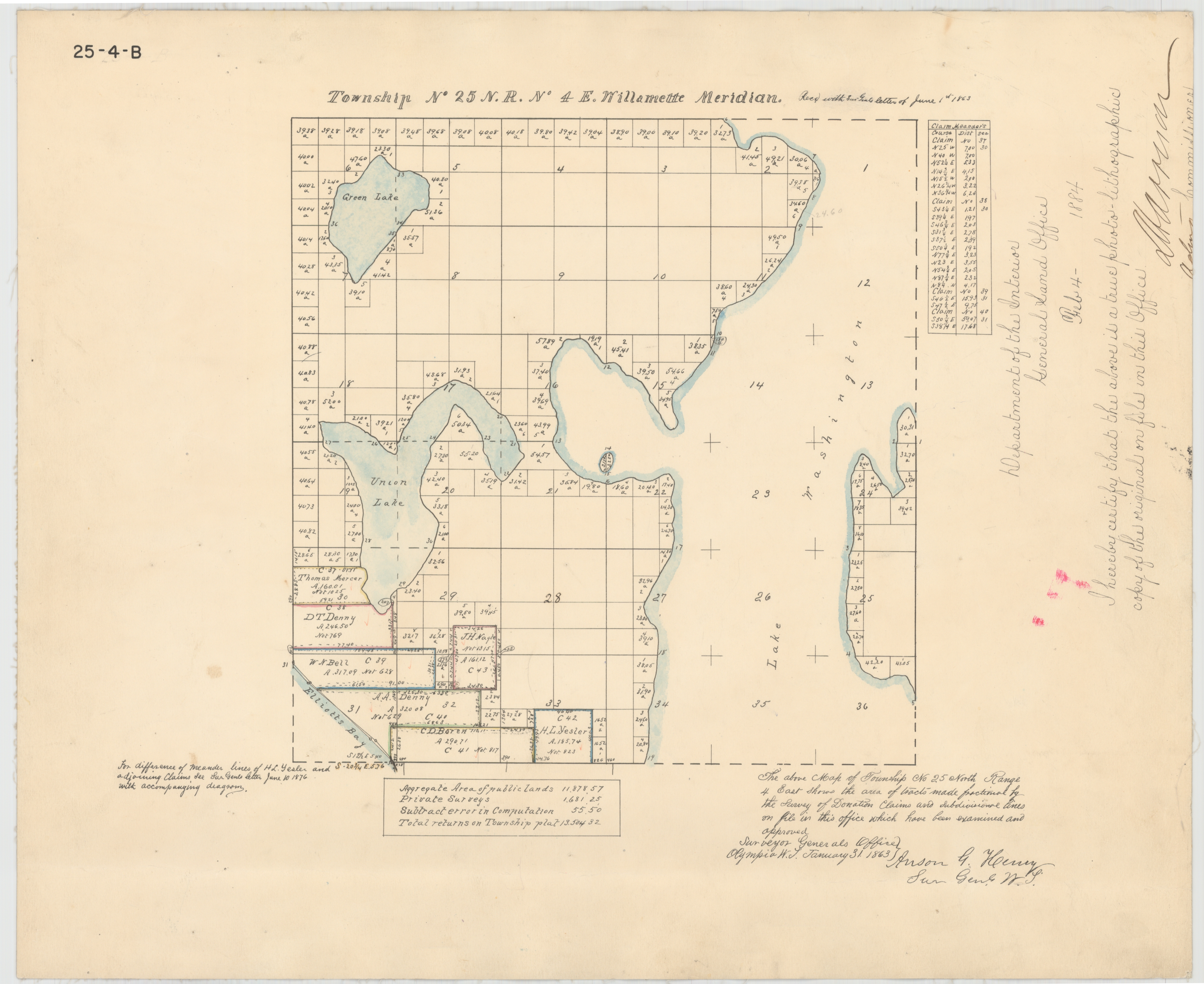
The meeting of 45th Street and Meridian Avenue began in the forest, when federal surveyors carrying their Gunter chains described — and marked — the future streets as the west (Meridian) and north (45th) borders for the 640 acres of federal land section number 17. That done, the settlers could identify their claims with some precision.
Indeed, King County’s quarter section map covering the intersection shows that (going clockwise) sections 7, 8, 17, and 18 of Township 25 North, Range 4 East, Willamette Meridian, meet there.
This means Meridian Avenue N is named after a meridian, but not the Willamette Meridian (which, once it reaches the latitude of Seattle, is on the Kitsap Peninsula), the Puget Sound Meridian, or the City Standard Meridian. As this overlay map I made shows (see below for the section of the map showing the intersection of 45th and Meridian), Fairview Avenue N follows the same alignment between Denny Way and Valley Street.
Meridian Avenue N begins at N Northlake Way just north of Gas Works Park and goes 1½ miles north to N 55th Street, where it becomes Kenwood Place N. It resumes at Kirkwood Place N just north of N 59th Street, and goes ¼ mile north to E Green Lake Way N. On the north side of the lake, there is a block-long stretch from E Green Lake Drive N to N 75th Street, and a longer, ¾-mile one from N 77th Street to N 92nd Street and North Seattle College. Meridian begins again at the north end of College Way N at N 103rd Street, and goes just under a mile to N 122nd Street, south of Haller Lake. It resumes on the north shore of the lake as a shoreline street end (though not on the city’s official list) and goes a mile north to the city limits at N 145th Street. As with most North Seattle avenues, the name continues into Shoreline, and in this case the arterial street itself keeps going for 3 more miles to the King–Snohomish county line at N 205th Street.
This street is named for Judge Thomas Burke (1849–1925), after whom the Burke–Gilman Trail and Burke Museum of Natural History and Culture are also named. In 1875, Burke, who was friends with the Bagley family, came to Seattle from Michigan, where he had attended law school. He began working with John McGilvra and ended up marrying his daughter, Caroline. He and Daniel Gilman were two of the founders of the Seattle, Lake Shore and Eastern Railway in 1885; the Burke–Gilman Trail today runs over the old railroad right-of-way. The Burke Museum, founded in 1885 by the Young Naturalists’ Society as Naturalists’ Hall, became the Washington State Museum in 1899 and took Burke’s name in the 1960s as part of a bequest from Caroline, who died seven years after her husband. He is also remembered for his defense of the rule of law during the period of peak anti-Chinese agitation in the 1880s. (He wanted the Chinese laborers to leave Seattle, but for this to happen non-violently, as opposed to what had happened in Tacoma.)
Thomas Burke, ca. 1910
Burke Avenue N begins at N Northlake Way and the Burke–Gilman Trail just north of Gas Works Park, and goes 1¼ miles north to N 50th Street. It resumes for a block at the north end of Green Lake between N 80th Street and N 82nd Street, and picks up again north of Bishop Blanchet High School at N 85th Street, going ⅓ of a mile north to N 92nd Street, where it becomes College Way N. With the exception of a few short segments, its next appearance is at N 135th Street, where it goes ½ a mile north to the city limits at N 145th Street. As with many other North Seattle avenues, the name continues on into Shoreline, and last appears as a short stub just north of N 203rd Street.
When I first posted this article, I wrote that Bagley Avenue N was named for Reverend Daniel Bagley (1818–1905) and his son, Clarence B. Bagley (1843–1932). That, after all, is what Sophie Frye Bass says in Pig-Tail Days in Old Seattle, which I pretty much took as gospel growing up. Junius Rochester says the same thing in his HistoryLink.org article on the Bagleys (using, I think, Pig-Tail Days as a reference.) And C.T. Conover (himself namesake of E Conover Court) repeats the story on two separate occasions for The Seattle Times — on February 18, 1950, and April 11, 1960.
However, today (September 10, 2021), I noticed that Conover had written a follow-up to his April 11 article. On April 25, 1960, he wrote that Clarence’s son, Colonel Cecil Clarence Bagley, had sent him a letter saying that, decades previous, he had asked his father if Bagley Avenue was named for his family. Daniel said no, it was named for Dr. Herman Beardsley Bagley (1845–1899). He had filed the plat of Bagley’s Addition in 1883. A small tract northeast of what is today Gas Works Park along the Lake Union shoreline, one of its streets was named Day Street. This later needed to be changed as it was duplicative of another Day Street elsewhere in the city. (I presume this is the S Day Street in Mount Baker that was almost entirely obliterated by the construction of what is now Interstate 90.) I can’t find the ordinance in question but, Conover continues, “as this was the central street in Dr. Bagley’s addition, it was considered appropriate to rename it Bagley Avenue in his honor, and that was done.”
The biography also says he was president for a time of the Seattle Improvement Company, which appears to be another name for the Lake Washington Improvement Company, one of many schemes to build what is today the Lake Washington Ship Canal. Jennifer Ott writes for HistoryLink.org that David T. Denny, along with Bagley and J. W. George, Corliss P. Stone, Thomas Burke, Frederick H. Whitworth, Benjamin F. Day, Erasmus M. Smithers, G. M. Bowman, Guy C. Phinney, John W. Van Brocklin, and William H. Llewellyn, formed the company in 1883, and, using Chinese laborers digging by hand, dug early versions of what are now the Fremont Cut and Montlake Cut.
Dr. Herman Beardsley Bagley
Even though it appears that Bagley Avenue N was not named for Daniel and Clarence Bagley, I’m leaving their biographical information as I originally wrote it, followed by the usual description of the street’s route.
The Bagleys came west in 1852 with, among others, Thomas Mercer and Dexter Horton, two other names familiar to those interested in Seattle history, but didn’t arrive in Seattle until 1860. The elder Bagley was one of the founders of the University of Washington in 1861; the younger was its first college student. Daniel Bagley also founded the Methodist Protestant “Little Brown Church” in 1865, so called to distinguish it from Seattle’s first church, the Methodist Episcopal “Little White Church.” (This church finally closed in 1993, by which time it had become the Capitol Hill United Methodist Church.) Clarence, who went on to marry one of Thomas Mercer’s daughters, is best remembered today for his multi-volume works on local history, including History of Seattle from the Earliest Settlement to the Present Timeand History of King County, Washington.
Daniel Bagley
Clarence B. Bagley
Bagley Avenue N begins at N 35th Street and N Pacific Street and goes a mile north to the Meridian Playground/Good Shepherd Center. It resurfaces north of Green Lake at E Green Lake Drive N and goes ½ a mile to N 85th Street. Besides a block-long stretch from N 106th Street to N 107th Street and another one north of N 133rd Street, it finishes up with a ¼-mile run from N 140th Street to the northern city limits at N 145th Street. Unlike many other North Seattle avenues, the name stops there and does not continue on into Shoreline, though there is a Bagley Drive N at the Ballinger Commons housing development.
Wallingford Avenue and the Wallingford neighborhood are named for real estate developer John Noble Wallingford (1833–1913). Originally from Maine, he moved to Massachusetts, then Minnesota as a young man. He fought for the Union all four years of the Civil War, and later moved to California before coming to Seattle in 1888. He was a city councilman from 1889 to 1891 and also a police commissioner.
John Noble Wallingford, ca. 1893
Wallingford Avenue N begins as the Wallingford Steps at N Northlake Way, just north of Gas Works Park. It then goes 1⅔ miles north from N 34th Street to Woodlawn Avenue N, just south of Green Lake. At the north end of Green Lake, it goes 1⅓ miles north from E Green Lake Drive N to N 105th Street at Mineral Springs Park. It picks up again at N 135th Street, just north of Ingraham High School, and goes ½ a mile to the northern city limits at N 145th Street. As with many other North Seattle avenues, the name continues on into Shoreline; its northernmost appearance is at the King–Snohomish county line at N 205th Street.
“A street of good intentions but easily thwarted,” as Sophie Frye Bass puts it in Pig-Tail Days in Old Seattle, John Street is “named for two Johns,” she writes — “For John Denny [1793–1875], the father of Arthur and David, and John B. [1862–1913], the son of David.”
John Denny
John Bunyan Denny
Today, W John Street begins at Western Avenue W and goes ⅓ of a mile east to 2nd Avenue N and the Pacific Science Center campus. John Street resumes just east of the Space Needle at Broad Street and goes ½ a mile to Terry Avenue N. Picking up half a block to the east, it makes it a further ⅓ of a mile before being blocked by Interstate 5 at Stewart Street and Eastlake Avenue E. Resuming at Melrose Avenue E, it goes ⅙ of a mile to E Olive Way, which itself becomes E John Street a few blocks to the east at Broadway E. From there, it’s ⅓ of a mile to the Kaiser Permanente Capitol Hill Medical Center at 15th Avenue E. After beginning again at 16th Avenue E, E John makes it nearly a mile before being stopped by the Harrison Ridge Greenbelt at 32nd Avenue E. Its final stretch is ⅓ of a mile from the 33rd Avenue E right-of-way to 39th Avenue E at Viretta Park.
This street — named Pine Street in Terry’s Second Addition to the Town of Seattle, filed in 1872 — was renamed Terrace in 1876, presumably to avoid duplicating the Pine Street to the north. My assumption is it was given this name because of how steep First Hill is at this point — Paul Dorpat, writing for HistoryLink, says “Except at Terrace Street on the south and near Union Street on the north, the hill was readily negotiable first by hikers and later by street graders and trolley tracks.” One can see in the image below the long, steep stairway in the Terrace Street right-of-way “from 5th Avenue east to beyond 7th Avenue,” as Dorpat writes on his own blog.
Seattle Weights and Measures Division officials standing with confiscated scales in Terrace Street, 1917. Note long stairway in upper-right corner. Courtesy of the Seattle Municipal Archives, Identifier 1210.
Today, Terrace Street begins at Yesler Way above 4th Avenue and goes a block and a half up the hill before being blocked by Interstate 5. It resumes just east of Harborview Medical Center and goes ⅓ of a mile east to 12th Avenue. There is another short stretch of E Terrace Street from 20th Avenue to 23rd Avenue by Garfield High School, and then a final ½ mile from 30th Avenue to Lake Washington Boulevard in Leschi, the portion between 36th Avenue and Randolph Avenue being a stairway.
“Street” appears above in quotation marks because there is no W Semple Street — not a physical one, anyway, making Semple a paper street. It does, however, still exist as a public right-of-way, as do most of the other streets on the plat, whether or not they were built. (As anyone who has been to Magnolia knows, its tidelands — intended to become industrial land as part of the rejected Bogue Plan — were never filled in, with the late exception of the Elliott Bay Marina.) Three residences even have a W Semple Street address, though they are only accessible from a private roadway off 45th Avenue W.
As can be seen below in the North Magnolia section of the plat map, a great many blocks were created as part of the process. Most of the unfilled tidelands are owned by the city (many of them forming Magnolia Tidelands Park), but some of the lots remain to this day in private ownership. There have been attempts to build on them, but none recently, and I can’t imagine such a thing being permitted in the future. So W Semple Street is likely to remain one of the few unbuilt streets in this plat to have addresses, and W Cole Street, Puget Avenue W, West Point Avenue W, and their ilk will forever remain streets on paper only.
This street was created in 1882 as part of Latta’s Addition to the City of Seattle, filed by Marion Cline Latta (1845–1924) and his wife, Mary (1867–1929). An architect, carpenter, and builder by trade, he came to Seattle in 1875 and left for what is now Bellingham in 1883; between then and 1918 he held various political offices, including city councilman, school board director, mayor, county commissioner, city treasurer, and city street superintendent.
In that plat, Orange Avenue, as it was then named, is to the east of Jacobs Avenue, which is today Warren Avenue N. When I first saw this, I immediately thought of Orange Jacobs (1827–1914), associate, then chief justice of the territorial supreme court from 1869 to 1875, territorial delegate to Congress from 1875 to 1879, mayor of Seattle from 1879 to 1880, territorial councilman from 1885 to 1887, city attorney in 1890, and superior court judge from 1896 to 1900.
I have no proof, of course, that Orange Avenue was named for Orange Jacobs — people rarely, if ever, documented why they gave particular names to streets in their subdivisions — but Jacobs and Latta were both Republicans and, more importantly, members of the same Masonic lodge, so for now I’m willing to put Jacobs down as the namesake of Orange Place N.
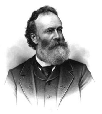
This short loop connects Lake Washington Boulevard E to 40th Avenue E and Denny Blaine Park on the Lake Washington waterfront. Street, park, and neighborhood — for the neighborhood is called Denny-Blaine too, though this time with a hyphen — are named for Charles Latimer Denny (1861–1919) and Elbert F. Blaine (1857–1942).
Denny was the youngest son of Arthur Armstrong Denny, leader of the Denny Party that landed at Alki Point in 1851; Blaine was a lawyer and parks commissioner from 1902 to 1908, and does not appear to be related to Catherine and David Blaine, after whom Blaine Street is named. Together, they operated the Denny-Blaine Land Company, and in 1901 filed the plat of Denny-Blaine-Lake Park to the City of Seattle (curiously, “Addition” seems to be missing before “to”). The street was originally named Whitman Place, and the park was unnamed; according to Seattle parks historian Don Sherwood, the street was renamed in 1918 to avoid confusion with Whitman Avenue N, and the park soon came to be known as Denny Blaine as well.
Charles Latimer Denny
Elbert F. Blaine
Incidentally, both portraits come from scans of newspapers; Blaine’s is from The Seattle Republican, September 27, 1912, and Denny’s is from the Seattle Post-Intelligencer, May 14, 1919 (his obituary). The original caption reads, in part:
The above photograph of Charles L. Denny was the last one he ever had taken. It was taken in the early nineties… and shows Mr. Denny, in the crude photography of that time, as he appeared when starting out on his successful business career.
This street was named for Carson Dobbins Boren (1824–1912), a member of the Denny Party that landed at Alki Point in November 1851. His sisters Mary Ann (1822–1910) and Louisa (1827–1916) married brothers Arthur (1822–1899) and David Denny (1832–1903) in 1843 and 1853, respectively. These weren’t the only Boren–Denny connections, either: his mother, Sarah Latimer Boren (1805–1888), who had been widowed in 1827, married John Denny (1793–1875) — Arthur and David’s father — in 1848. (Their mother, also named Sarah, had died in 1841.)
Boren is said to have built the first cabin in Seattle, at what is now 2nd Avenue and Cherry Street, in April 1852. He was elected King County’s first sheriff the same year. Boren’s land claim of 320 acres covered what is today a rectangle approximately bounded by (going clockwise) Yesler Way, 15th Avenue, E Cherry Street and its projection west, and Western Avenue and its projection north, but he sold it for $500 to Charles Terry and Edward Lander in 1855.*
* “Its projection” is necessary here because of Boren and Arthur Denny’s decision to have their street grid follow the shoreline, while “Doc” Maynard preferred his to follow the cardinal directions; Maynard’s grid eventually extended through the entire city and, indeed, county. (See “Seattle’s first streets.”) The actual southern boundary is a bit north of Yesler Way since both Boren and Maynard adjusted their initial claims to give Henry Yesler land to build and supply his sawmill.
Why Boren sold his land isn’t entirely clear. Sophie Frye Bass writes in Pig-Tail Days in Old Seattle that he sold it “early at a great sacrifice and became a roamer and, therefore, did not share in the up-building of the town”; her sister, Roberta Frye Watt, is indirectly quoted by Junius Rochester thus: “Carson had an unhappy home life. This compelled him to move deeper and deeper into the forest; to hunt and dream; and to shed most of his possessions.” Indeed, he and his wife, Mary Ann, divorced in 1861.
Carson Dobbins Boren
Today, Boren Avenue S begins at 14th Avenue S, Rainier Avenue S, and S Jackson Street, and goes 2⅕ miles north to Valley Street and Lake Union Park, becoming Boren Avenue as it crosses Yesler Way and Boren Avenue N as it crosses Denny Way. It is one of the few north–south streets in Seattle to have three directional designations.
We no longer remember the exact circumstances that led to the naming. The fable is that Stroud earned the name by clearing the road, though. Originally one block long, the road was in Wood’s Green Lake Home Addition in 1892 (filed by later-mayor William Wood). Also in 1892 Fred worked for John Wallingford, whose daughter Emma was married to William Wood.
Today, Stroud Avenue N begins at E Green Lake Drive N and goes ¼ mile northeast, then north, to N 82nd Street.
Like most streets and walkways on the University of Washington campus, Pend Oreille Road NE is named after a Washington county — in this case, Pend Oreille County, which is located in the northeast corner of the state, bordering both Canada and Idaho.
It struck me as I was writing this post that I don’t know the history of how or when this decision was reached. I will look into this — if anyone has any insight, please let me know!
Pend Oreille Road NE is the east entrance to the university campus. It begins at 25th Avenue NE and NE 44th Street by University Village and goes ⅓ of a mile up the hill to E Stevens Way NE between Clark Hall, Communications Building, and Padelford Hall.
Corliss Avenue N begins at N Northlake Way on the borth shore of Lake Union and goes nearly a mile north through Wallingford to the Good Shepherd Center just north of N 46th Street. There is another stretch from N 59th Street to N 65th Street in Green Lake. North of the lake, Corliss goes nearly another mile from East Green Lake Drive N to N 92nd Street and the North Seattle College campus. There are a few more segments through Haller Lake, the longest one being ¾ of a mile long from N 130th Street to the city limits at N 145th Street. As with other North Seattle avenues, the name continues on into Shoreline; its northernmost appearance is at N 194th Street.
Stone Way N begins on the north shore of Lake Union at N Northlake Way and Waterway 22, and goes 1⅕ miles north to N 50th Street and Green Lake Way N. It forms an unofficial boundary between the Fremont and Wallingford neighborhoods.
It has proved difficult to find a good photo of Phinney — this, the only one I could find online, is a group shot taken from a distance, so it’s hard to make him out — but I was able to find the below advertisement. His offer to refund the purchase price of “any lot, block, or acre” sold by him since 1881, with interest, is an impressive one — I wonder if anyone took him up on it? Ladd’s Addition later became part of Carleton Park; with the help of David Rumsey’s Georeferencer, I was able to determine that Governor Ferry’s blocks were located east of what is now W Viewmont Way W, between Parkmont Place W and W Raye Street.
An advertisement by Phinney in the Seattle Post-Intelligencer, March 4, 1888
Phinney Avenue N begins at N 34th Street in Fremont and goes just over 2 miles north to N 70th Street on Phinney Ridge. Resuming at N 85th Street in Greenwood, it goes ¾ of a mile north to N 100th Street. There is another 1¼-mile stretch from N 105th Street to N 130th Street in Bitter Lake, and then a final two blocks between N 141st Street and the city limits at N 145th Street. As with many North Seattle avenues, the Phinney name continues on into Shoreline; its northernmost appearance is just south of N 200th Street.
This street is named for Dr. Henry A. Smith (1830–1915), after whom Smith Cove is also named. He and his family once owned most of what is now Interbay, between Smith Cove and Salmon Bay. He is likely best known today for his translation of Chief Seattle’s Speech. Though its authenticity has been questioned, it is accepted by the Suquamish Tribe and Duwamish Tribe, both of which siʔaɫ was chief.
Dr. Henry A. Smith
Today, W Smith Street begins in Magnolia at the intersection of 37th Avenue W and 36th Avenue W and goes ⅘ of a mile east to just past 24th Avenue W, briefly becoming a stairway just west of 26th Avenue W at Ella Bailey Park. It begins again in Queen Anne at 7th Avenue W and goes ½ a mile east to Warren Avenue N, forming a portion of Queen Anne Boulevard between 1st Avenue W and Warren Avenue N. Smith Street’s final segment begins at 4th Avenue N and goes a block east, ending at a greenbelt overlooking Aurora Avenue N.
This street is named for Thomas Dickerson Mercer (1813–1898), who came to Seattle in 1853 and homesteaded 160 acres in what is now Lower Queen Anne, living at what is now Roy Street and Taylor Avenue N. He became a King County commissioner and probate judge, and named Lake Washington and Lake Union, whose Lushootseed names are x̌ačuʔ and xáx̌əʔčuʔ(‘lake’ and its diminutive, respectively). Mercer Island is named for him, as are three of its main streets, W Mercer Way, N Mercer Way, and E Mercer Way. Mercer Slough in Bellevue is named for his brother Aaron (1826-1902), and his brother Asa (1839–1917) is known for being the first instructor at, and first president of, the Territorial University of Washington (being the only college graduate in Seattle in 1861); and for bringing the “Mercer Girls” to Seattle to address the settlement’s severe gender imbalance (thereby inspiring the 1960s TV show Here Come the Brides).
Thomas Dickerson Mercer
Today, W Mercer Street begins at Elliott Avenue W and goes a block east to 6th Avenue W, where it becomes a stairway. At the top of the stairway, the street becomes a major arterial (connecting directly to Elliott via W Mercer Place) and goes 1⅔ miles east to Eastlake Avenue E and Lakeview Boulevard E, where it is blocked by Interstate 5. (It is, incidentally, laid out on the boundary between the donation land claims of Mercer and David Thomas Denny. Mercer’s claim is today bounded by Queen Anne Avenue N on the west, Lake Union on the east, Highland Drive on the north, and Mercer Street on the south.) Connecting Interbay, Lower Queen Anne, Seattle Center, State Route 99, South Lake Union, Interstate 5, and Capitol Hill, Mercer Street is a linchpin of Seattle’s transportation system — but not a beloved one, having earned the name “Mercer Mess” decades ago.
East of Interstate 5, E Mercer Street begins again at Melrose Avenue E and goes nearly 1½ miles to 28th Avenue E, interrupted only once, at 17th Avenue E, where it is pedestrian-only for half a block. Mercer resumes briefly at Dewey Place E but after a couple hundred feet becomes a stairway connecting to Lake Washington Boulevard E and 31st Avenue E. A block east of that, at 32nd Avenue E, E Mercer Street resumes as another stairway, and becomes a street again just west of 33rd Avenue E. This segment goes about ⅛ of a mile to 36th Avenue E. There is one final 200-foot-long segment of E Mercer Street east of 39th Avenue E. Platted into Lake Washington, this is a shoreline street end, but not, unfortunately, one open to the public. (It was this particular street end that first got me involved with Friends of Street Ends, as I grew up just ¼ of a mile up the hill.)
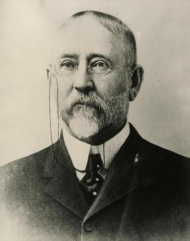
All in one year John McGraw was Chief of Police, Marshall, Sheriff, Harbor Master and Fire Warden. Later he was Governor of Washington and in between, bank president and attorney-at-law — quite a career.
The second governor of Washington after statehood (1893–1897), he had been King County sheriff during the anti-Chinese riots of 1886. He defended Chinese laborers from the mob that was trying to expel them from the city, although, according to The Role of Federal Military Forces in Domestic Disorders, 1877–1945, he initially sympathized with the rioters and allowed them to force the Chinese (without physically harming them) to the waterfront to be loaded onto the steamship Queen of the Pacific. Both he and Mayor Henry Yesler lost their bids for re-election that summer in what the book calls “a resounding show of support for anti-Chinese forces.”
John H. McGraw
Today, W McGraw Street begins as a shoreline street end on Elliott Bay in Magnolia west of Perkins Lane W. It begins in earnest at the intersection of Westmont Way W, Montavista Place W, and Rosemont Place W and goes ⅘ of a mile east to 24th Avenue W, forming the heart of Magnolia Village, the neighborhood’s commercial district, from 35th Avenue W to 32nd Avenue W. It resumes on the other side of Interbay in Queen Anne, beginning at 11th Avenue W and going 1⅛ miles east to the Northeast Queen Anne Greenbelt east of Bigelow Avenue N. There are a few block-long segments heading down the hill to Westlake and, like Blaine Street, a right-of-way platted into Lake Union that serves as a driveway and affords no actual lake access.
E McGraw Street doesn’t appear again until 15th Avenue E and Boyer Avenue E in Montlake, where it goes ⅔ of a mile east to 26th Avenue E at the west end of the Washington Park Arboretum, becoming a stairway for a short distance just before 19th Avenue E. It ends for good in Madison Park as a two-block stretch between 38th Avenue E and 40th Avenue E.
Unfortunately, though the Blaines may have been feminists, they, according to HistoryLink.org, had no love for Native Americans (or, for that matter, the Irish). Their departure in 1856 was prompted by the Battle of Seattle. Junius Rochester writes:
On January 20, 1856, a son John, was born to Catharine and David Blaine. Six days later the Battle of Seattle erupted. David had duty at one of the blockhouses, but managed to get Catharine and their babe aboard the Decatur in Elliott Bay. David had described the Indians as a “poor degraded race,” which would “soon disappear.” Catharine compared their “stupidity and awkwardness” to that of the Irish. The Indian uprising confirmed their worst fears and prejudices.
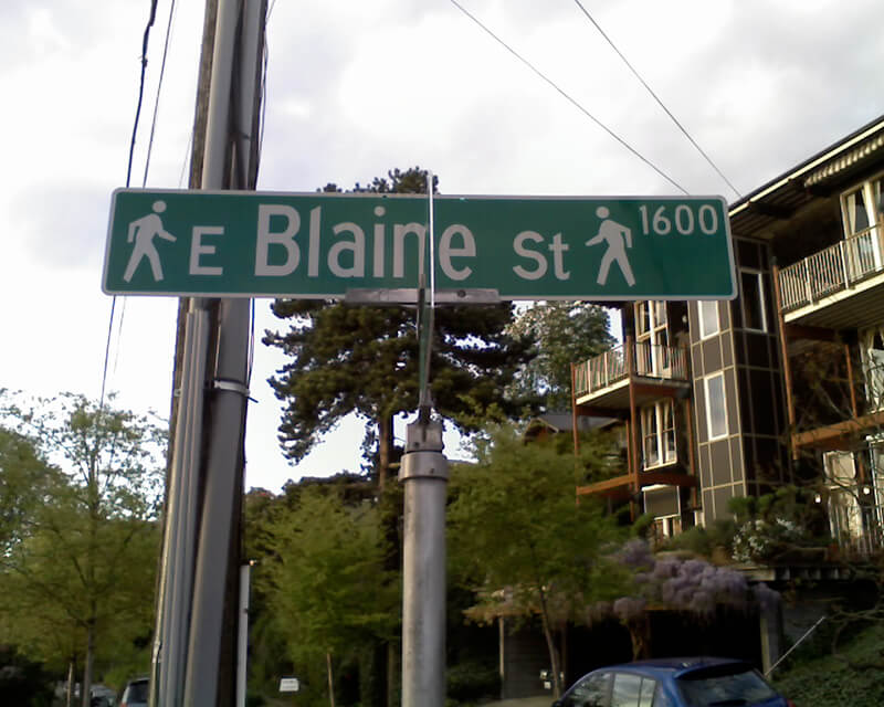
Today, W Blaine Street begins in Magnolia at 36th Avenue W and goes a semicircular ⅕ of a mile to 34th Avenue W and W Howe Street. It resumes at 31st Avenue W and goes almost ⅓ of a mile to Thorndyke Avenue W. There is a stub of W Blaine east of 15th Avenue W that is quickly stopped by the Southwest Queen Anne Greenbelt. The street resumes at 12th Avenue W and goes just over a mile to 4th Avenue N, having briefly become a stairway at 9th Avenue W. After a series of short stretches serving as driveways and parking, the Blaine Street right-of-way resurfaces east of Westlake Avenue N and heads into Lake Union. Here, too, it serves as a driveway and offers no access to the water. East of Lake Union, E Blaine Street begins at Fairview Avenue E and goes ⅛ of a mile to Franklin Avenue E, where it becomes part of the I-5 Colonnade park underneath the freeway. From Lakeview Boulevard E to just west of 10th Avenue E it is a stairway, and then two blocks of roadway ending at 12th Avenue E and Lake View Cemetery. There is then a diagonal ¼-mile stretch from 19th Avenue E to E Howe Street in Montlake. E Blaine finishes up as a ⅕-mile stretch from 37th Avenue E to McGilvra Boulevard E and a final two-block run from E Madison Street to 43rd Avenue E, both in Madison Park.


