We no longer remember the exact circumstances that led to the naming. The fable is that Stroud earned the name by clearing the road, though. Originally one block long, the road was in Wood’s Green Lake Home Addition in 1892 (filed by later-mayor William Wood). Also in 1892 Fred worked for John Wallingford, whose daughter Emma was married to William Wood.
Today, Stroud Avenue N begins at E Green Lake Drive N and goes ¼ mile northeast, then north, to N 82nd Street.
Corliss Avenue N begins at N Northlake Way on the borth shore of Lake Union and goes nearly a mile north through Wallingford to the Good Shepherd Center just north of N 46th Street. There is another stretch from N 59th Street to N 65th Street in Green Lake. North of the lake, Corliss goes nearly another mile from East Green Lake Drive N to N 92nd Street and the North Seattle College campus. There are a few more segments through Haller Lake, the longest one being ¾ of a mile long from N 130th Street to the city limits at N 145th Street. As with other North Seattle avenues, the name continues on into Shoreline; its northernmost appearance is at N 194th Street.
Stone Way N begins on the north shore of Lake Union at N Northlake Way and Waterway 22, and goes 1⅕ miles north to N 50th Street and Green Lake Way N. It forms an unofficial boundary between the Fremont and Wallingford neighborhoods.
It has proved difficult to find a good photo of Phinney — this, the only one I could find online, is a group shot taken from a distance, so it’s hard to make him out — but I was able to find the below advertisement. His offer to refund the purchase price of “any lot, block, or acre” sold by him since 1881, with interest, is an impressive one — I wonder if anyone took him up on it? Ladd’s Addition later became part of Carleton Park; with the help of David Rumsey’s Georeferencer, I was able to determine that Governor Ferry’s blocks were located east of what is now W Viewmont Way W, between Parkmont Place W and W Raye Street.
An advertisement by Phinney in the Seattle Post-Intelligencer, March 4, 1888
Phinney Avenue N begins at N 34th Street in Fremont and goes just over 2 miles north to N 70th Street on Phinney Ridge. Resuming at N 85th Street in Greenwood, it goes ¾ of a mile north to N 100th Street. There is another 1¼-mile stretch from N 105th Street to N 130th Street in Bitter Lake, and then a final two blocks between N 141st Street and the city limits at N 145th Street. As with many North Seattle avenues, the Phinney name continues on into Shoreline; its northernmost appearance is just south of N 200th Street.
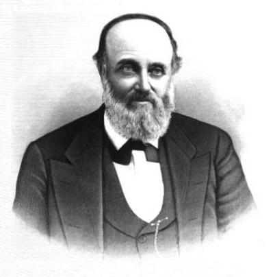
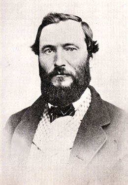
This street is named for Dr. Henry A. Smith (1830–1915), after whom Smith Cove is also named. He and his family once owned most of what is now Interbay, between Smith Cove and Salmon Bay. He is likely best known today for his translation of Chief Seattle’s Speech. Though its authenticity has been questioned, it is accepted by the Suquamish Tribe and Duwamish Tribe, both of which siʔaɫ was chief.
Dr. Henry A. Smith
Today, W Smith Street begins in Magnolia at the intersection of 37th Avenue W and 36th Avenue W and goes ⅘ of a mile east to just past 24th Avenue W, briefly becoming a stairway just west of 26th Avenue W at Ella Bailey Park. It begins again in Queen Anne at 7th Avenue W and goes ½ a mile east to Warren Avenue N, forming a portion of Queen Anne Boulevard between 1st Avenue W and Warren Avenue N. Smith Street’s final segment begins at 4th Avenue N and goes a block east, ending at a greenbelt overlooking Aurora Avenue N.
This street is named for Thomas Dickerson Mercer (1813–1898), who came to Seattle in 1853 and homesteaded 160 acres in what is now Lower Queen Anne, living at what is now Roy Street and Taylor Avenue N. He became a King County commissioner and probate judge, and named Lake Washington and Lake Union, whose Lushootseed names are x̌ačuʔ and xáx̌əʔčuʔ(‘lake’ and its diminutive, respectively). Mercer Island is named for him, as are three of its main streets, W Mercer Way, N Mercer Way, and E Mercer Way. Mercer Slough in Bellevue is named for his brother Aaron (1826-1902), and his brother Asa (1839–1917) is known for being the first instructor at, and first president of, the Territorial University of Washington (being the only college graduate in Seattle in 1861); and for bringing the “Mercer Girls” to Seattle to address the settlement’s severe gender imbalance (thereby inspiring the 1960s TV show Here Come the Brides).
Thomas Dickerson Mercer
Today, W Mercer Street begins at Elliott Avenue W and goes a block east to 6th Avenue W, where it becomes a stairway. At the top of the stairway, the street becomes a major arterial (connecting directly to Elliott via W Mercer Place) and goes 1⅔ miles east to Eastlake Avenue E and Lakeview Boulevard E, where it is blocked by Interstate 5. (It is, incidentally, laid out on the boundary between the donation land claims of Mercer and David Thomas Denny. Mercer’s claim is today bounded by Queen Anne Avenue N on the west, Lake Union on the east, Highland Drive on the north, and Mercer Street on the south.) Connecting Interbay, Lower Queen Anne, Seattle Center, State Route 99, South Lake Union, Interstate 5, and Capitol Hill, Mercer Street is a linchpin of Seattle’s transportation system — but not a beloved one, having earned the name “Mercer Mess” decades ago.
East of Interstate 5, E Mercer Street begins again at Melrose Avenue E and goes nearly 1½ miles to 28th Avenue E, interrupted only once, at 17th Avenue E, where it is pedestrian-only for half a block. Mercer resumes briefly at Dewey Place E but after a couple hundred feet becomes a stairway connecting to Lake Washington Boulevard E and 31st Avenue E. A block east of that, at 32nd Avenue E, E Mercer Street resumes as another stairway, and becomes a street again just west of 33rd Avenue E. This segment goes about ⅛ of a mile to 36th Avenue E. There is one final 200-foot-long segment of E Mercer Street east of 39th Avenue E. Platted into Lake Washington, this is a shoreline street end, but not, unfortunately, one open to the public. (It was this particular street end that first got me involved with Friends of Street Ends, as I grew up just ¼ of a mile up the hill.)
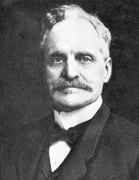
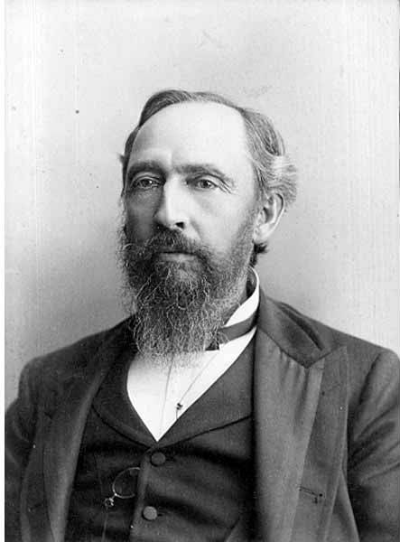
All in one year John McGraw was Chief of Police, Marshall, Sheriff, Harbor Master and Fire Warden. Later he was Governor of Washington and in between, bank president and attorney-at-law — quite a career.
The second governor of Washington after statehood (1893–1897), he had been King County sheriff during the anti-Chinese riots of 1886. He defended Chinese laborers from the mob that was trying to expel them from the city, although, according to The Role of Federal Military Forces in Domestic Disorders, 1877–1945, he initially sympathized with the rioters and allowed them to force the Chinese (without physically harming them) to the waterfront to be loaded onto the steamship Queen of the Pacific. Both he and Mayor Henry Yesler lost their bids for re-election that summer in what the book calls “a resounding show of support for anti-Chinese forces.”
John H. McGraw
Today, W McGraw Street begins as a shoreline street end on Elliott Bay in Magnolia west of Perkins Lane W. It begins in earnest at the intersection of Westmont Way W, Montavista Place W, and Rosemont Place W and goes ⅘ of a mile east to 24th Avenue W, forming the heart of Magnolia Village, the neighborhood’s commercial district, from 35th Avenue W to 32nd Avenue W. It resumes on the other side of Interbay in Queen Anne, beginning at 11th Avenue W and going 1⅛ miles east to the Northeast Queen Anne Greenbelt east of Bigelow Avenue N. There are a few block-long segments heading down the hill to Westlake and, like Blaine Street, a right-of-way platted into Lake Union that serves as a driveway and affords no actual lake access.
E McGraw Street doesn’t appear again until 15th Avenue E and Boyer Avenue E in Montlake, where it goes ⅔ of a mile east to 26th Avenue E at the west end of the Washington Park Arboretum, becoming a stairway for a short distance just before 19th Avenue E. It ends for good in Madison Park as a two-block stretch between 38th Avenue E and 40th Avenue E.
Unfortunately, though the Blaines may have been feminists, they, according to HistoryLink.org, had no love for Native Americans (or, for that matter, the Irish). Their departure in 1856 was prompted by the Battle of Seattle. Junius Rochester writes:
On January 20, 1856, a son John, was born to Catharine and David Blaine. Six days later the Battle of Seattle erupted. David had duty at one of the blockhouses, but managed to get Catharine and their babe aboard the Decatur in Elliott Bay. David had described the Indians as a “poor degraded race,” which would “soon disappear.” Catharine compared their “stupidity and awkwardness” to that of the Irish. The Indian uprising confirmed their worst fears and prejudices.
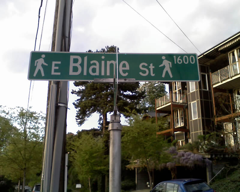
Today, W Blaine Street begins in Magnolia at 36th Avenue W and goes a semicircular ⅕ of a mile to 34th Avenue W and W Howe Street. It resumes at 31st Avenue W and goes almost ⅓ of a mile to Thorndyke Avenue W. There is a stub of W Blaine east of 15th Avenue W that is quickly stopped by the Southwest Queen Anne Greenbelt. The street resumes at 12th Avenue W and goes just over a mile to 4th Avenue N, having briefly become a stairway at 9th Avenue W. After a series of short stretches serving as driveways and parking, the Blaine Street right-of-way resurfaces east of Westlake Avenue N and heads into Lake Union. Here, too, it serves as a driveway and offers no access to the water. East of Lake Union, E Blaine Street begins at Fairview Avenue E and goes ⅛ of a mile to Franklin Avenue E, where it becomes part of the I-5 Colonnade park underneath the freeway. From Lakeview Boulevard E to just west of 10th Avenue E it is a stairway, and then two blocks of roadway ending at 12th Avenue E and Lake View Cemetery. There is then a diagonal ¼-mile stretch from 19th Avenue E to E Howe Street in Montlake. E Blaine finishes up as a ⅕-mile stretch from 37th Avenue E to McGilvra Boulevard E and a final two-block run from E Madison Street to 43rd Avenue E, both in Madison Park.
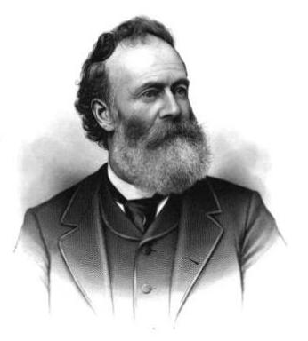
Dillis Ward, when a young man, did his part in building the old University for he drove a team that hauled stone and lime for the foundation. After the building was finished, he entered as a pupil into the first class. He taught school later on, and many an old-timer can recall the genial, kindly school teacher.
According to this biography, Ward, who came to Seattle in 1859, also had a hand in founding both The Post (a predecessor of the Seattle Post-Intelligencer) and The Seattle Daily Chronicle (a predecessor of The Seattle Times). However, his name does not appear in Professor Edmond S. Meany’s Newspapers of Washington Territory, in this article on the Post Building from the Pacific Coast Architecture Database, or in this HistoryLink article on the history of the P-I. All of them do mention brothers Kirk C. and Mark Ward, but Dillis’s entry at FamilySearch mentions no siblings, and Mark and Kirk’s entries do not mention Dillis. However, they do appear to have the same father, Jesse Ward. It looks as if Dillis was Jesse’s son from his first marriage, to Elizabeth Raley. As she died the same year Dillis was born, it may have been in childbirth. Kirk and Mark appear to be Jesse’s sons from his subsequent marriage to Exeline Cason. Exactly what part he may have played in the founding of the papers, and why this is missing from the articles above (and, incidentally, from Pig-Tail Days, which one would think might have mentioned this fact) is unclear.
Ward Street begins at Queen Anne Avenue N and goes ⅗ of a mile east to Aurora Avenue N. There is a short segment of E Ward Street on Capitol Hill between 14th Avenue E and 15th Avenue E, followed by another one, ⅓ of a mile long, from 23rd Avenue E and Turner Way E down the hill to 29th Avenue E and E Aloha Street, at the west end of Washington Park Playfield. There follows another one-block segment on the other side of the park, between 31st Avenue E and 32nd Avenue E, and a final segment from 34th Avenue E to 37th Avenue E.
Like SW Bataan Street, Lanham Place SW is part of High Point, originally developed by the Seattle Housing Authority in 1942 as defense housing and redeveloped in 2004. The name was originally applied to SW Lanham Way, and was preserved while some other names, including SW Snow Court, Cycle Lane SW, and MacArthur Court SW, were eliminated. It was named for Fritz G. Lanham, Texas congressman, who sponsored the Lanham Act that created the Defense Homes Corporation.
Today, Lanham Place SW begins at 32nd Avenue SW and SW Raymond Street and goes ¼ mile southeast to 31st Avenue SW, Sylvan Way SW, and SW Morgan Street.
This hook-shaped street on Beacon Hill begins where S Myrtle Street turns into Swift Avenue S, and goes just over 700 feet north, west, and then south to a point 300 feet to the northwest. It was created in 1967 as the only street in the plat of Covello Estates, filed by S.T. Covello, whose full name appears to be Salvatore Tony Covello (1913–1996). He was the son of Filippo and Josephine (Curreri) Covello, who came to the United States from Italy in 1908. An article in the September 25, 1946, Seattle Times mentions him as the owner of the Hillman City Radio and Electric Company, and one in the March 4, 1956, Times lists him as a candidate for the King County Board of Education.
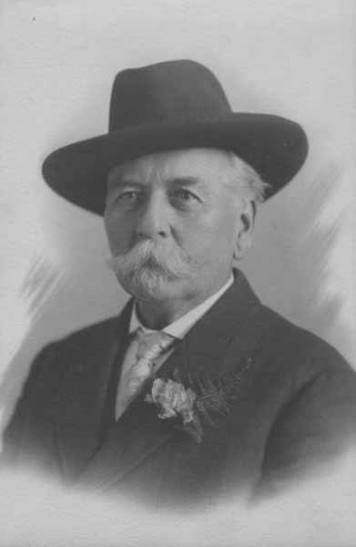
This street, which appears to have been established as part of the 1906 Replat of McGilvra’s Addition and Second Addition to the City of Seattle (an abbreviation of its much longer name), was named for John J. McGilvra (1827–1903). Born in Livingston County, New York, McGilvra moved to Illinois at the age of 17, and became a lawyer nine years later. In 1861, President Abraham Lincoln, who McGilvra reportedly knew as a fellow Illinois lawyer, appointed him United States Attorney for the Territory of Washington. In 1864, he moved to Seattle. That same year, he and his wife, Elizabeth, bought 420 acres of land in what is now Madison Park and became the area’s first settlers. McGilvra had Madison Street extended to the lakefront — it is still the only street to extend from Elliott Bay to Lake Washington without interruption — and later helped establish the Madison Street Cable Railway Company and Madison Park at its eastern terminus. In 1865 he relinquished the post of U.S. attorney. He was a member of the Territorial Legislature in 1866 and 1867, and Seattle city attorney in 1876 and 1877. He retired in 1890.
John J. McGilvra, circa 1890
Today, McGilvra Boulevard E begins in the south at 39th Avenue E and Lake Washington Boulevard E and goes 1⅖ miles north to E McGilvra Street. Unlike most other boulevards in the city, it is not an Olmsted boulevard — McGilvra was reportedly opposed to the movement that resulted in the hiring of the Olmsted Brothers in 1903 (the year of his death) to design a system of parks and boulevards for Seattle, though there is no evidence the two are directly related.
An ordinance accepting deeds from Hubert W. Youngs and Maude E. Youngs, husband and wife, Harry Richmond, William G. Knox, and Bessie S. Woodworth, for an easement for sewer over and across a portion of J. J. McGilvra’s 2nd Addition and Lake Washington Shore Lands.
Since Knox Place is very close to where the two plats meet, I figure it’s a good bet that William G. Knox has something to do with Knox Place. FamilySearch says a William Gifford Knox (1884–1964) lived in Seattle for a time, and even had a scan of his draft registration card for World War I, from September 12, 1918. He appears to have been a salesman for the Dennison Manufacturing Company downtown, and his address is given as 1836 Laurel Shade Avenue. That street is now 43rd Avenue E, putting his residence just a few blocks north of Knox Place E. So, although I don’t have the whole story, I think we now know who Knox Place is named for.
William Gifford Knox draft registration card for World War I, September 12, 1918
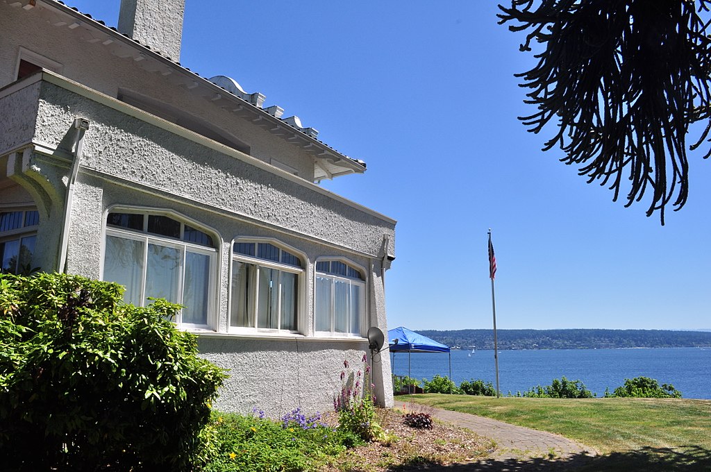
This short street in Seattle’s Windermere neighborhood runs from 60th Avenue NE and NE 55th Street in the southwest to 63rd Avenue NE and NE 57th Street in the northeast. It was likely named after Lochkelden, the mansion built in 1907 for Rolland Herschel Denny (1851–1939) and his wife, Alice Martha Kellogg Denny (1857–1940). Rolland was just six weeks old when the Denny Party landed at Alki Point in November 1851. Lochkelden — owned since 1974 by Sun Myung Moon’s Unification Church — was itself named for Lake Washington, of which it has a commanding view (loch being Scottish for ‘lake’) and its owners: Kellogg and Denny.
It isn’t often that a vintage newspaper article explicitly states the reason behind a new street’s naming, but when it comes to Radford Drive, we’re in luck. On November 30, 1940, the Seattle Post-Intelligencer reported, under the headline ‘Work started at Sand Point Homes project’, that ground had been broken the day before on a project to house 150 enlisted men, plus their families, from the adjacent Sand Point Naval Air Station. (The project was said to cost $620,000, which is ¾ of the average price of a single home in Seattle today!) Rather amusingly, the air station’s commandant, Captain Ralph Wood, is quoted as saying “the days when the sailor was a bachelor and a derelict have long since passed” as justification for the need for military family housing. The article goes on to say that:
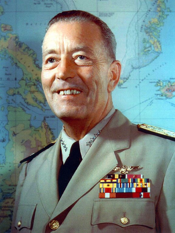
Street entrance to the area will be named Radford Drive in honor of Commander Arthur W. Radford, former commandant of the Sand Point base, who launched the expansion program which has resulted in its present growth.
Arthur W. Radford (1896–1973), who had been appointed commandant in 1939, was promoted to captain in 1942 and to rear admiral in 1943. He became vice admiral in 1945, and was appointed by President Harry S. Truman as vice chief of naval operations in 1948. In 1949, he was made high commissioner of the Trust Territory of the Pacific Islands as well as commander-in-chief of the U.S. Pacific Fleet, and in 1953 he became President Dwight D. Eisenhower’s selection as chairman of the Joint Chiefs of Staff. He retired from the Navy in 1957.
Admiral Arthur W. Radford
Today, the housing complex, redeveloped in 2001, is known as Radford Court, and is owned by the University of Washington, though some units are available to the public. Interestingly, the entrance to the neighborhood from NE 65th Street is signed Radford Drive NE and is on University-owned land, while the publicly owned street is legally NE Radford Drive, but not signed at all — and the addresses for the complex are on 65th Avenue NE (one of the city streets, the other being NE 64th Street, that connects directly to the property).*
* Yes, NE 65th Street and 65th Avenue NE intersect here. Because of how Seattle’s street naming system works, Windermere and Laurelhurst are the site of a number of similar intersections, including those for 60th, 59th, 57th, 55th, 54th, 50th, 47th, 45th, 43rd, 41st, and 40th.
In the early 1870s, the Denny and Mercer families gradually began to systematically subdivide their large land holdings on the south and east slopes of Queen Anne Hill. When a severe windstorm blew down thousands of trees in the north district in 1875, views opened up and land seekers turned their attentions beyond Belltown. Real estate speculators new to the territory arrived and began to buy up property on the crest of Queen Anne Hill. Some of these speculators also became developers, such as George Kinnear, or builder-developers, such as Isaac Bigelow.
Though its proximity to Boston and Lynn Streets suggest a tribute to Newton, Massachusetts, neither the Georges nor the Bigelows appear to have a connection to the state, so it seems this one should be chalked up to Isaac Bigelow’s middle name.
Today, Newton Street begins in Magnolia as W Newton Street at 30th Avenue W, and goes nearly half a mile east to 23rd Avenue W. There is then a two-block stretch from 15th Avenue W to 13th Avenue W in Interbay, and then the “original” Newton Street, which stretches almost a half mile from 1st Avenue N to Taylor Avenue N, followed by another two-block stretch from Dexter Avenue N to just past 8th Avenue N. On the east side of Lake Union, E Newton Street picks up again at Terry Pettus Park, just west of Fairview Avenue E, and goes ¼ mile to Boylston Avenue E and Lakeview Boulevard E. There follows another ¼-mile stretch from Broadway E to Everett Avenue E. East of there, Newton exists in a number of short segments through Montlake, and then enjoys a run of ⅓ of a mile from 37th Place E to 43rd Avenue E in Madison Park.
For Blanchard Street, I can do no better than to quote Sophie Frye Bass, who in Pig-Tail Days in Old Seattle writes:
The name of Blanchard Street had long been a puzzle to me, but when I looked over some records of 1872 and found where John M. Blanchard had been one of the witnesses when my grandfather, Arthur Denny, platted a tract of land, then I knew.
Blanchard Street was part of A.A. Denny’s 6th Addition to the City of Seattle, filed in 1873, and indeed John M. Blanchard is one of the witnesses, along with Duncan T. Wheeler. Blanchard appears to have been city treasurer in 1879, as well as an insurance agent. Wheeler is referred to in 1871 as being a merchant, and in 1874 he and Blanchard apparently attended a masquerade ball dressed as members of the Ku Klux Klan(!), predating the establishment of an actual Klan chapter by half a century. (Their wives went as a “Canadian Squaw” and the “Queen of Chess,” respectively.)
Today, Blanchard Street begins at Elliott Avenue and goes just over half a mile to the northwest, where it ends at Westlake Avenue.
Unlike S Charles Street, which makes it all the way to Lake Washington, S Plummer Street runs a mere block from Airport Way S and Maynard Avenue S in the west to 7th Avenue S in the east, where it is stopped by the city’s Charles Street Service Center.
Charles Street originates in the 1876 plat of Plummer’s Addition to the City of Seattle, filed by George Washington Harris (late 1840s–1914).* How did Harris end up with the land, and why would he name the addition after Charles Plummer (who, it appears from the text of the plat description, bought the tract from David Swinson “Doc” Maynard in 1860)?
As it turns out: Plummer married Ellender Smith (sister of Dr. Henry A. Smith, namesake of Smith Cove and Smith Street) in 1855. Harris’s mother, Sarah Jane Crossman, was widowed the next year. Plummer himself became a widower when his wife died giving birth to twins Edward and Frank in 1859, and he married Harris’s mother in 1860, apparently at Maynard’s own Alki Point house. Harris then became Plummer’s stepson (and a daughter, Ida, was born to the newlyweds the next year). When Plummer died in 1866, Harris apparently inherited at least this much of his stepfather’s estate. (It’s unclear just what Edward and Ida may have received; Frank is reported to have inherited $60,000.)
Charles Plummer
Today, S Charles Street begins at Airport Way S and 6th Avenue S and is stopped a block and a half to the east at 7th Avenue S by the city’s Charles Street Service Center. (Its twin to the south, S Plummer Street, also ends at the service center, never to return.) It briefly reappears at the northern lip of Beacon Hill between 12th Avenue S and Sturgus Avenue S, and then east of Interstate 90 runs for about ⅓ of a mile between Poplar Place S and 20th Place S at Judkins Park. The right-of-way, which continues through the park, becomes an improved street again at 22nd Avenue S, and ends just east of 26th Avenue S. East of here, S Charles runs three blocks from 28th Avenue S to 30th Avenue S, and then around ¼ mile made up of alternating roadway and stairways from the alley west of 32nd Avenue S to a shoreline street end on Lake Washington — one of Leschi’s String of Pearls.
Because its original location is covered by King County Metro’s Atlantic Base and Interstate 5, Judkins Street now starts on Beacon Hill just west of 12th Avenue S and goes around 850 feet east to just east of 14th Avenue S, where it becomes a stairway to 15th Avenue S. The unimproved right-of-way continues through a greenbelt to 16th Avenue S, where there exists a 100-foot stretch of Judkins before it is stopped by Sturgus Avenue S, Daejon Park, and Interstate 90. On the other side of I-90, it resumes at 20th Avenue S and goes ⅘ of a mile east to Lake Washington Boulevard S, the last 50 or so feet being a stairway. Between Lake Washington Boulevard S and Lakeside Avenue S, only the first 150 feet is improved, mainly serving as a driveway for two houses. And east of Lakeside Avenue S there is a very short stretch that, like its neighbor to the north, S Norman Street, turns into a shoreline street end on Lake Washington — one of Leschi’s String of Pearls.
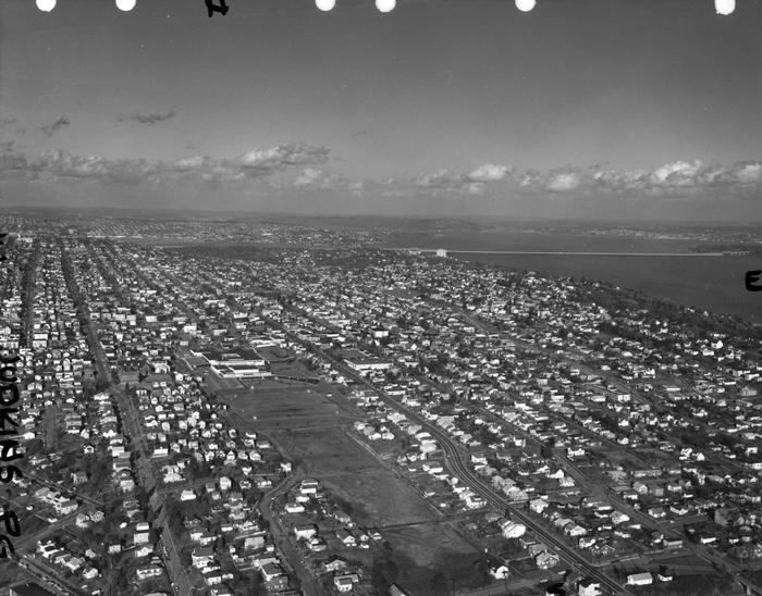
Built on the site of a former ravine landfill that was used for about four decades, Judkins Park was transferred to the parks department in the late 1940s and early 1950s, and opened to the public on October 8, 1977, according to a story in the October 6 issue of The Seattle Times.
Aerial view of Judkins Park and Playfield, 1965. Courtesy of the Seattle Municipal Archives, Identifier 29470. S Judkins Street is at bottom center and right, below the park. Washington Middle School is at the north end of the park and 23rd Avenue S is the arterial to its east. Lake Washington and the Evergreen Point Floating Bridge (Washington State Route 520) are visible in the distance.
For the origin of S Norman Street, we go back to our first street name post, SW Seattle Street, which read in part:
On August 4, 1869, Ike M. Hall — the executor of the estate of Norman B. Judkins — filed the Judkin’s (sic) Addition to the Town of Seattle, located just southwest of where the interchange between I-5 and I-90 is today. From north to south, the east–west streets are named Norman, B, Judkins, Addition, Town, and Seattle.
Today, S Norman Street begins on the other side of Beacon Hill, the portion shown above having been obliterated by King County Metro’s Atlantic Base and Interstate 5. (In fact, S Addition Street is the only one remaining in its original location, Judkins Street now starting on Beacon Hill and Seattle Street only existing in West Seattle.) Beginning at Poplar Place S just east of Interstate 90, it goes for a block northeast to Rainier Avenue S. It picks up again at Davis Place S and S Bush Place and goes a block east to 21st Avenue S. Resuming at 22nd Avenue S, just east of Judkins Park (also named for Norman B. Judkins), it goes ⅗ of a mile east to 33rd Avenue S, with only two short interruptions:
An unimproved stretch south of St. Gebriel Ethiopian Orthodox Church between 26th Avenue S and Martin Luther King Jr. Way S: what looks to be a bramble patch followed by a driveway for some townhouses; and
A stairway from 31st Avenue S to half a block west of 32nd Avenue S.
There appears to be a privately maintained stairway from 33rd Avenue S down to Lake Washington Boulevard S, and the next block is completely unimproved, though in both cases neighbors appear to be incorporating the right-of-way into their yards and driveways. Finally, there is a short stretch of Norman Street east of Lakeside Avenue S that turns into a shoreline street end on Lake Washington — one of Leschi’s String of Pearls.
King County Parcel Viewer showing S Norman Street between 26th Avenue S and Martin Luther King Jr. Way S. What appears to be a private driveway from Martin Luther King is actually public right-of-way.King County Parcel Viewer showing S Norman Street from 33rd Avenue S to Lake Washington. The private driveway in the public right-of-way east of Lake Washington Boulevard S (center of image) is easily visible, as is the shoreline street end east of Lakeside Avenue S.
This Magnolia street, which goes not quite 700 feet from 37th Avenue W just south of W Armour Street in the south to W Fulton Street just west of 36th Avenue W in the north, originated in 1939 as part of the plat of Carleton Park Terrace, an Addition to the City of Seattle, filed by C.F. Bishop, Jr., his wife, Elizabeth, and the city of Seattle itself, owners of the land in question.
Charles F. Bishop, Jr. (1881–1963) was — according to his Seattle Post-Intelligencer and Seattle Times obituaries, and based on information in his father’s Times obituary from 1943 — born in Brockport, New York, near Rochester, and came to Seattle when he was 18. The elder Bishop was a marine engineer for the Alaska Steamship Company and the Puget Sound Navigation Company. Bishop Jr. was a grocery wholesaler who ran the Puget Sound Quality Stores (PSQ Stores) cooperative, which, according to local historian Paul Dorpat in his April 6, 1986 Now & Then column for the P-I, was a predecessor of Associated Grocers — now, after a number of mergers and acquisitions, part of United Natural Foods.
Bishop founded Modern Home Builders, Inc., with his brother, Ralph Waldo Bishop, Sr., in 1940, the year after he filed the plat of Carleton Park Terrace. This particular plat of his carried no racial restrictive covenants, but the adjacent Carleton Park Terrace Division № 3, filed in 1941, did, banning non-whites from living in the subdivision unless they were domestic servants of white residents.
The neighborhood of Lawtonwood, or Lawton Wood — both spellings have been in use over the years — is perched atop Discovery Park north of W Cramer Street. Lawtonwood Road, which goes through the park, is the only way in or out. It would have been a natural part of Fort Lawton, and it certainly would have made a great addition to the park, but as local historian Paul Dorpat explains in his introduction to the neighborhood,
Steady white settlement started in 1875 when German immigrant Christian Scheuerman moved to the area, cleared the timber and married a native woman who had ten children before she died in 1884. In 1895 Seattle boosters organized to attract a military post to the area and gathered the acreage that is now Fort Lawton–Discovery Park. The part of it that is now Lawton Wood… is not part of the military holding because Scheuerman withheld it.
It should not be thought that Scheuerman cared nothing at all for the defense of Seattle — he and his family did donate 26.13 acres to the cause — though that made up less than 4% of the 704.21 acres given in total. (The single largest contributors of land were Thomas W. Prosch and his wife, Virginia, who gave 330.97 acres, a full 47%.)
Dorpat continues:
Soon after the military moved in next door, this protected enclave was improved with mansions of a few of Seattle’s elite. In 1952 these neighbors — about 30 houses sparingly distributed about a generous 30 acres – organized the Lawton Wood Improvement Club, waving the motto “To Beautify and Develop Lawton Wood.” By the time that the last of the Scheuermans, Ruby, moved out in the late 1970s, the beautifying had turned more to developing, and the lots got smaller.
The first reference to Lawtonwood Road I was able to find in The Seattle Times or the Seattle Post-Intelligencer is from 1935, but it does not appear to have been officially so designated until 2007. According to ordinance 122503, park roads “are considered ‘private’” — technically residents of Lawtonwood and Bay Terrace had no legal right to transit the park to reach their homes, though of course they had never been prevented from doing so. To rectify this and other issues, and in anticipation of the privatization of the residences on Officers’ Row and Montana Circle, the ordinance made Lawtonwood Road, Bay Terrace Road, Utah Street, Washington Avenue, California Avenue, Iowa Street, Illinois Avenue, Texas Way, Idaho Avenue, and 45th Avenue W “public park boulevards.”
Note, by the way, that none of these streets except 45th Avenue W contain a directional designation. Ordinarily one would expect to see W Lawtonwood Road, or Lawtonwood Road W, but park roads in Seattle carry no directional designation. An exception seems to have been made for 45th Avenue W, presumably because a numbered avenue with no directional designation “belongs” in Madrona or Leschi, seven miles to the southeast.
The bulk of W Lawton Street comes not from the Lawton Park plat, which covered 34th Avenue W to 36th Avenue W, but from a grant from the federal government in 1909 for sewer and street purposes. Lawton Street was laid out along the north edge of the fort, from its northwest corner at 36th Avenue W to what is now 40th Avenue W. There is a short discontinuity beginning about 250 feet east of 40th Avenue W consisting of a footpath and stairs; I’m not sure when that was created, but I don’t think it was the original configuration, as that would have defeated the purpose of the street.
Even though it had been named that for years, and was signed as such, its name was not officially made Maynard Alley S until 2019, so that addresses from which 911 calls were coming could be more easily located and emergency vehicle response times could be reduced. (The same thing was done for Canton Alley S, a block to the east, as part of the same ordinance.)
(The earliest reference I can find to Maynard Alley in The Seattle Star, The Seattle Times, or the Seattle Post-Intelligencer is an article in the March 30, 1910, issue of the P-I.)
Portion of summary and fiscal note to ordinance 125753 regarding Maynard Alley S
This street begins at Colorado Avenue S in the west, at an onramp to the northbound lanes of the State Route 99 tunnel, and goes ⅔ of a mile east to Airport Way S. Originally S Connecticut Street, it was renamed in 1979 in honor of sportswriter Royal Brougham (1894–1978), who worked for the Seattle Post-Intelligencer newspaper from 1910 until his death. Such a name change was formally proposed by city councilman George Benson following a suggestion by P-I columnist Emmett Watson. Originally it was to be Occidental Avenue S whose name was to be changed, then the 2nd Avenue S Extension when objections were raised. Finally S Connecticut Street was settled upon; it was thought to be particularly appropriate because he “worked so hard to see the Kingdome built… and eventually spent his last day on earth there.”
Lumen Field, built on the former Kingdome site, is on the north side of Royal Brougham between 1st Avenue S and 4th Avenue S; and T-Mobile Park is on the south side between 1st Avenue S and 3rd Avenue S.
This street, formerly the 1600 block of S Lander Street, runs between 16th and 17th Avenues S on Beacon Hill, north of the Beacon Hill light rail station and south of the Plaza Roberto Maestas housing development of El Centro de la Raza, a social service agency. It was renamed in 2011 in honor of Roberto Maestas (1938–2010), who co-founded El Centro in 1972 in the recently closed Beacon Hill Elementary School.
The street is one of a number of “festival streets” in the city of Seattle: “designated portions of streets intended for frequent public events.” E Barbara Bailey Way is the other one we’ve covered so far.
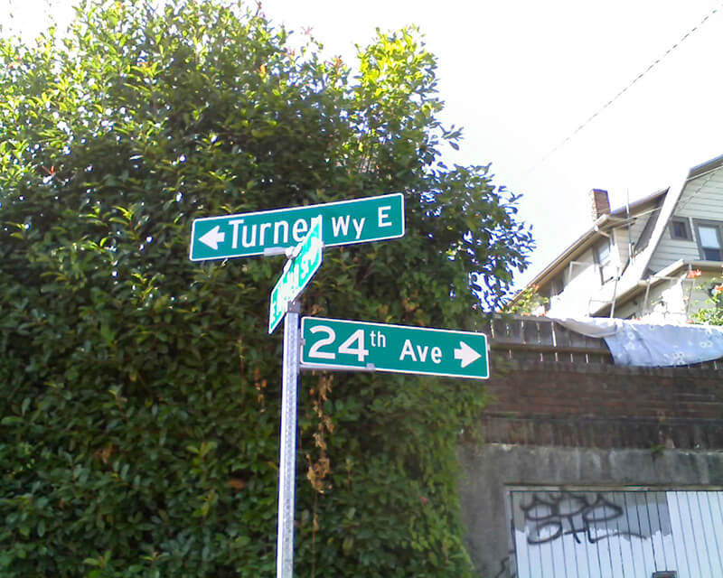
This 275-foot-long diagonal street connects 23rd Avenue E to 24th Avenue E between E Ward Street and E Helen Street, allowing the arterial that begins at Jefferson Park on Beacon Hill to have “an easy grade to the Boulevard and Washington Park,” as the advertisement below for the Capitol Hill Addition, Division No. 6 in the October 28, 1905, issue of The Seattle Times explains. (The prediction that “in the near future there is almost sure to be a street car direct to the University” along this route was an accurate one.”
Advertisement for Capitol Hill Addition Division No. 6 in October 28, 1905, issue of The Seattle Times
The plat was filed at the request of H.S. Turner on May 25, 1905. Herbert S. Turner (1866–1941) was also involved in developing parts of Montlake, the International District, and the University District.
This was a route I took often as a child, and my working theory then was that it was called Turner because, well, you turned onto it when going from 23rd to 24th, or vice versa. Now, 40 years later, I know better.
Paragraph on establishment of Puget Sound Construction Company in 1886
In his article “The Orphan Railroad and the Rams Horn Right of Way,” in the April 1923 issue of The Washington Historial Quarterly, C.H. Hanford writes of the SLS&E, “A number of Seattle men… subscribed to the capital of the new company to the extent of their means, and having gained so much, Gilman and Judge Burke were successful in inducing Philip D. Armour of Chicago to advance the money required to start the enterprise.” So it is unclear just which Armour brother the street is named for — perhaps it is named for them both.
W Armour Street starts at 1st Avenue N and goes two blocks west to 1st Avenue W, where it is stopped by Rodgers Park. It makes it two more blocks, from 3rd Avenue W to 5th Avenue W, before again being stopped, this time by Mount Pleasant Cemetery. From there it exists in a number of short segments, including paths and stairs, before being stopped, once again, by the Interbay Golf Center at 15th Avenue W. Once across the railroad tracks in Magnolia, there is a nearly uninterrupted ¾ mile stretch from Thorndyke Avenue W to the West Magnolia Playfield at 32nd Avenue W, and then a few more short segments west of 34th Avenue W, ending for good at 46th Avenue W. (There is a shoreline street end off Perkins Lane W, but it is currently inaccessible.)


.jpg)