Oberlin Avenue NE is another one of the “university” streets in the Hawthorne Hills subdivision, created in 1928. It was named for Oberlin College in Oberlin, Ohio, and runs around ⅕ of a mile from 45th Avenue NE in the northwest to Princeton Avenue NE in the southeast.
Tag: Place
Wellesley Way NE
Wellesley Way NE is another one of the “university” streets in the Hawthorne Hills subdivision, created in 1928. It was named for Wellesley College in Wellesley, Massachusetts, and runs around ⅕ of a mile from NE 65th Street in the north to NE 60th Street and Ann Arbor Avenue NE in the south.
Vassar Avenue NE
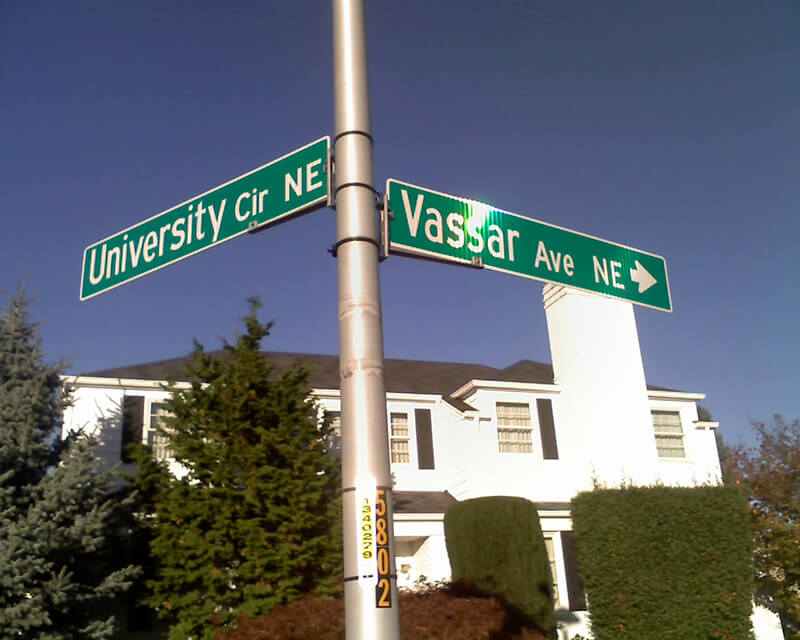
Vassar Avenue NE, another one of the “university” streets in the Hawthorne Hills subdivision, created in 1928, was named for Vassar College in Poughkeepsie, New York. It runs almost ⅖ of a mile from NE 65th Street in the northwest to Stanford Avenue NE in the southeast.

Street sign at corner of University Circle NE and Vassar Avenue NE, October 6, 2010. Photograph by Benjamin Lukoff. Copyright © 2010 Benjamin Lukoff. All rights reserved. Ann Arbor Avenue NE
Another one of the “university” streets in the Hawthorne Hills subdivision, created in 1928, Ann Arbor Avenue NE was named for the University of Michigan, located in Ann Arbor, Michigan. It runs nearly ½ a mile from Pullman Avenue NE in the south to NE 65th Street in the north.
Purdue Avenue NE
Purdue Avenue NE is another one of the “university” streets in the Hawthorne Hills subdivision, created in 1928. It was named for Purdue University in West Lafayette, Indiana. It runs almost ½ a mile from NE 58th Street and 45th Avenue NE to from NE 60th Street and 51st Avenue NE.
NE Tulane Place
Another one of the “university” streets in the Hawthorne Hills subdivision, created in 1928, NE Tulane Place was named for Tulane University in New Orleans, Louisiana. It runs diagonally a mere tenth of a mile from NE 57th Street and 45th Avenue NE to NE 55th Street.
Pullman Avenue NE
This is another one of the “university” streets in the Hawthorne Hills subdivision, created in 1928. It was named for Washington State College, now Washington State University, in Pullman, Washington.
Pullman Avenue NE begins as an extension of NE 55th Street east of Princeton Avenue NE and goes ⅓ of a mile northeast to NE 60th Street, where it becomes 52nd Avenue NE.
Princeton Avenue NE
This is one of the “university” streets in the Hawthorne Hills subdivision, created in 1928. It was named for Princeton University in Princeton, New Jersey.
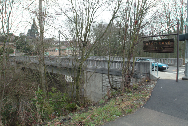
Princeton Avenue NE begins in the south as a bridge crossing the Burke–Gilman Trail just north of Sand Point Way NE, and goes ½ a mile north to NE Princeton Way.

Princeton Avenue Bridge, January 28, 2003. Courtesy of the Seattle Municipal Archives, identifier 141197 
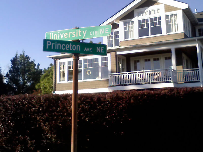
Street sign at corner of University Circle NE and Princeton Avenue NE, October 6, 2010. Photograph by Benjamin Lukoff. Copyright © 2010 Benjamin Lukoff. All rights reserved. University Circle NE
An article in the July 8, 1928, issue of The Seattle Times describes the new subdivision of Hawthorne Hills thus:
The property is situated on a “hogback” between East 55th and East 65th Streets just east of 35th Avenue Northeast.… It is the largest single piece of undeveloped residence property in the city limits.… Because of its proximity to the University of Washington a community center at the highest point on the property has been designated “University Circle.” At this point, 200 feet in diameter, the principal thoroughfares, named after well-known universities and colleges, converge.
University Circle park is ringed by 400-foot-long University Circle NE, which is approximately 125, not 200, feet in diameter. Vassar Avenue NE, Ann Arbor Avenue NE, and Princeton Avenue NE converge on the circle, while Wellesley Way NE, Stanford Avenue NE, Purdue Avenue NE, Pullman Avenue NE, NE Tulane Place, and Oberlin Avenue NE curve through the rest of the neighborhood. (There does not appear to be any organizing concept behind the selection of schools other than the fact they are institutions of higher education. Pullman and Ann Arbor represent state schools; Princeton, Stanford, Purdue, and Tulane private schools; and Vassar and Wellesley women’s colleges; but why these in particular were chosen, I am not sure. Incidentally, Dartmouth, Harvard, Cornell, Yale, Columbia, and Amherst were already in use elsewhere.)

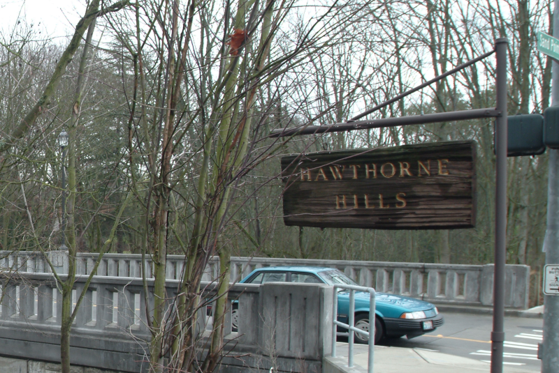
Hawthorne Hills sign, January 28, 2003. Courtesy of the Seattle Municipal Archives, identifier 141197 Unfortunately, Hawthorne Hills — named for Hawthorne Kingsbury Dent, founder of what is today Safeco Insurance — was among the subdivisions in Seattle to which the developers attached racially restrictive covenants. In fact, according to the Seattle Civil Rights and Labor History Project, “Seattle’s first known racial restrictive covenant was written in 1924 by the Goodwin Company,” which also developed Hawthorne Hills, and
No property in this subdivision could be “sold, conveyed, rented, nor leased, in whole or in part, to any person not of the White race; nor shall any person not of the White race be permitted to occupy any portion of said lot or lots or of any building thereon, except a domestic servant actually employed by a White occupant of such building.”
Two good articles on Hawthorne Hills are “Names in the Neighborhood: From Keith to Hawthorne Hills,” by Valarie Bunn, and “Squatting in Hawthorne Hills,” by Zach van Schouwen.
Florentia Street
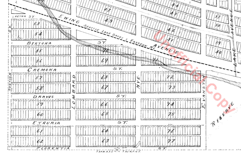
Florentia Street is the last in a series of streets, created in 1888 as part of Denny & Hoyt’s Addition to the City of Seattle, Washington Territory, that appear in alphabetical order and have the common theme of being locations in Italy. From north to south, they are Aetna, Bertona, Cremona, Dravus, Etruria, and Florentia. As can be seen in the plat map below, Florentia is not only the last in the series but the southern boundary of the plat itself.
Florentia is the Latin name of the city of Florence, known in Italian as Firenze.

Portion of plat map of Denny and Hoyt’s Addition to the City of Seattle, Washington Territory (1888) showing Aetna, Bertona, Cremona, Dravus, Etruria, and Florentia Streets Some detail in addition to that gone into in the post on Dravus Street:
- Aetna Street no longer exists, portions having been vacated in 1973 and 1974. Seattle Pacific University’s Royal Brougham Pavilion and Wallace Field now occupy the old right-of-way. Its name referred to Mt. Etna in Sicily, known in Latin as Aetna.
- More than half of Denny and Hoyt’s Addition is in what is now Fremont, north of the Fremont Cut of the Lake Washington Ship Canal, which was not finished until 1917. In a sense, this part of Queen Anne is more Fremont than Queen Anne. In the plat map above, the two are separated by Ross Creek and the Seattle, Lake Shore and Eastern Railway; the modern quarter section map covering the area shows nicely how the canal sliced through.
Florentia Street begins in the east at 4th Avenue N (the southern end of the Fremont Bridge) and goes ½ a mile west to 3rd Avenue W.
Etruria Street
Etruria Street is another one of those streets created in 1888 as part of Denny & Hoyt’s Addition to the City of Seattle, Washington Territory, part of a series — Aetna, Bertona, Cremona, Dravus, Etruria, and Florentia — that appear in alphabetical order and have the common theme of being locations in Italy. Etruria, the land of the ancient Etruscans, was located in what is now the regions of Tuscany, Lazio, and Umbria, northwest of Rome.
Etruria Street begins in the east at the Ship Canal Trail and 3rd Avenue N, and goes just over ⅖ of a mile west to 3rd Avenue W. It resumes east of 8th Avenue W at a Seattle Pacific University parking lot and goes a further ¼ of a mile west to 10th Avenue W.
Cremona Street
Cremona Street is another street created in 1888 as part of Denny & Hoyt’s Addition to the City of Seattle, Washington Territory, part of a series of streets — Aetna, Bertona, Cremona, Dravus, Etruria, and Florentia — that appear in alphabetical order and have the common theme of being locations in Italy. Cremona, or Cremùna in the local dialect, is a city in Lombardy, perhaps best known for its luthiers, most notably Antonio Stradivari.
Cremona Street begins in the east at the Ship Canal Trail and goes ¼ of a mile west to 3rd Avenue W and the entrance to Seattle Pacific University. On the other side of campus it goes a further ⅕ of a mile west from 6th Avenue W to 9th Avenue W.
W Bertona Street
This street, as with Dravus Street, was created in 1888 as part of Denny & Hoyt’s Addition to the City of Seattle, Washington Territory, and is also is part of a series of streets — Aetna, Bertona, Cremona, Dravus, Etruria, and Florentia — that appear in alphabetical order and have the common theme of being locations in Italy. Montebello di Bertona (Mundibbèlle in the Abruzzese dialect) is a small town in Pescara, Abruzzo, located near Mt. Bertona.
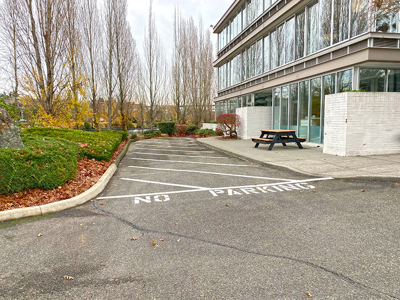
Technically, W Bertona Street begins as Bertona Street at the Ship Canal Trail around 80 feet east of Queen Anne Avenue N, but both streets there are little more than parking aisles nestled up against Seattle Pacific University’s Wallace Field. W Bertona begins in earnest at W Nickerson Street and goes ¾ of a mile west to 14th Avenue W, where it becomes a block-long stairway to 15th Avenue W. On the other side of 15th, it goes two more blocks before being stopped by the BNSF Railway tracks at 17th Avenue W; on the other side of the tracks it goes ⅗ of a mile west from 20th Avenue W to 30th Avenue W, becoming a stairway again for a block just about halfway. As with its Magnolia partner W Dravus Street, it’s ⅓ of a mile from 31st Avenue W to 36th Avenue W, where it becomes a stairway for a block, and then ½ a mile more from 37th Avenue W to 45th Avenue W. There is finally a 300-foot-long segment west of Perkins Lane W, where the roadway ends. (There is a shoreline street end beyond that, but it is currently inaccessible.)

Bertona Street east of Queen Anne Avenue N, November 2021. The 2 Nickerson Street office building is at right; the row of trees is between the Ship Canal Trail and the Fremont Cut. Fremont and the Aurora Bridge are visible in the distance. Photograph by Benjamin Lukoff. Copyright © 2021 Benjamin Lukoff. All rights reserved. Dravus Street
This street was created in 1888 as part of Denny & Hoyt’s Addition to the City of Seattle, Washington Territory by Edward Blewett and his wife, Carrie, of Fremont, Nebraska, who had purchased the land a few months earlier from Arthur Denny and John Hoyt. According to Valarie Bunn in her article “Fremont in Seattle: Street Names and Neighborhood Boundaries,” Edward Corliss Kilbourne may have done much of the actual naming of streets as attorney-in-fact for the Blewetts.

Portion of plat map of Denny and Hoyt’s Addition to the City of Seattle, Washington Territory (1888) showing Aetna, Bertona, Cremona, Dravus, Etruria, and Florentia Streets As can be seen in the plat map above, Dravus is part of a series of streets — Aetna, Bertona, Cremona, Dravus, Etruria, and Florentia — that appear in alphabetical order and have the common theme of being locations in Italy, which had been unified 17 years earlier. I have yet to find a connection between Denny, Hoyt, the Blewetts, or Kilbourne and Italy. The closest I’ve come is an item in the February 28, 1903, issue of The Seattle Mail and Herald, which reports that “on February 27, the Woman’s Century Club met and discussed the subject ‘Italian Art and Literature.’ Mrs. Bessie L. Savage and Mrs. E.C. Kilbourne [Leilla Shorey] prepared papers relating to these subjects.” I would love to find out if there’s anything more solid!
The Drava River, which originates in the Italian region of the South Tyrol, flows from there through Austria, Slovenia, and Croatia, forming much of the border between that country and Hungary, and joining the Danube on the Croatia–Serbia border. It was known as Dravus in Latin and Δράβος in Greek.
Dravus Street begins in the east at Nickerson Street and goes ⅗ of a mile west to 8th Avenue W and Conkling Place W. It resumes for half a block at 10th Avenue W, is briefly a foot path and stairway, and then is an arterial connecting Queen Anne and Magnolia via Interbay, going just over a mile from 11th Avenue W to 30th Avenue W. (This section was originally known as Grand Boulevard, and indeed W Dravus is double the width of the other streets in the area, though it features wide planting strips instead of a central median.) It’s ⅓ of a mile from 31st Avenue W to 36th Avenue W, where it becomes a stairway for a block, and then ½ a mile more from 37th Avenue W to just west of Magnolia Boulevard W, where the roadway ends. (There is a shoreline street end off Perkins Lane W, but it is currently inaccessible.)
S River Street
S River Street is just ½ a mile long, and none of it parallels the Duwamish River. The reason behind this is the same reason S Front Street is perpendicular to the waterway — the rechanneling of the Duwamish River that began in 1913. In Joseph R. McLaughlin’s Water Front Addition to the City of Seattle, filed in 1906, Front Street had a horseshoe shape. North Front Street is today’s Front Street, and South Front Street was changed to River Street in 1907, when West Seattle was annexed to Seattle. The Baist Atlas depiction of the Oxbow, below left, is from 1912, so has the modern name.


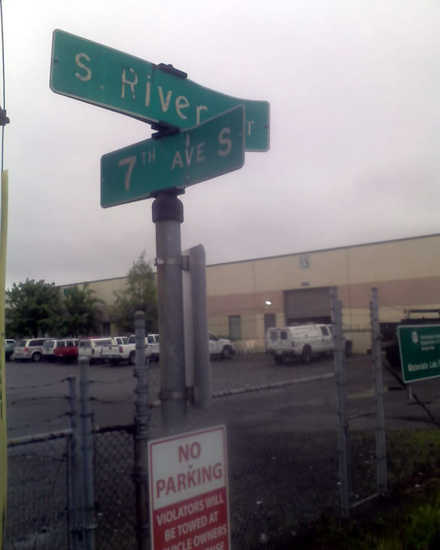
Today’s S River Street begins at 7th Avenue S and goes ½ a mile west, ending at 1st Avenue S, below the 1st Avenue S Bridge.

Signs at corner of S River Street and 7th Avenue S, May 22, 2013. Photograph by Benjamin Lukoff. Copyright © 2013 Benjamin Lukoff. All rights reserved. Vashon Place SW
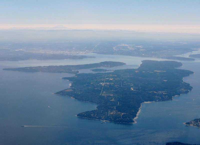
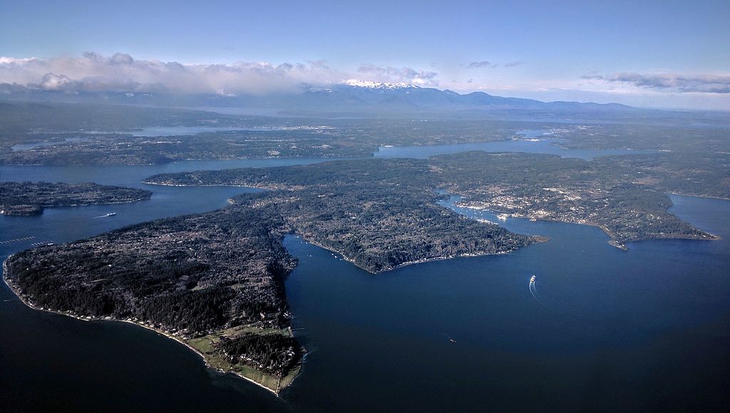
This street — just about 350 feet long, like its neighbor Blake Place SW — connects SW Othello Street to Fauntleroy Way SW just north of Solstice Park. Created as part of the Lincoln Home Addition in 1907 by builder Albert Eugene Felmley and his wife, Mabel L. Felmley, it is named after Vashon Island, located 4 miles to the southwest, across Puget Sound. The island itself was named for Royal Navy Admiral James Vashon by his friend, Royal Navy Captain George Vancouver, in 1792.
Two other streets in the Lincoln Home Addition are named for Puget Sound islands: the already-mentioned Blake Place SW, and Bainbridge Place SW.

Aerial view of Vashon and Maury Islands from the northwest. Photograph by Flickr user Travis, licensed under Creative Commons Attribution-NonCommercial 2.0 Generic Blake Place SW
This 350-foot-long street connects SW Othello Street to SW Fontanelle Street just north of Solstice Park. It was created as part of the Lincoln Home Addition in 1907 by builder Albert Eugene Felmley and his wife, Mabel L. Felmley, and is named after Blake Island, located 4⅖ miles to the west, across Puget Sound. The island itself was named for U.S. Navy Commodore George Smith Blake, then head of the United States Coast Survey, by Charles Wilkes in 1841.
Two other streets in the Lincoln Home Addition are named for Puget Sound islands: Bainbridge Place SW and Vashon Place SW.

Aerial view of Blake Island from the east (West Seattle in foreground). Photograph by Joe Mabel, Wikimedia Commons, licensed under Creative Commons Attribution-Share Alike 3.0 Unported Bainbridge Place SW
This short street — not quite 275 feet long — connects SW Othello Street to Fauntleroy Way SW just north of Lincoln and Solstice Parks. Created as part of the Lincoln Home Addition in 1907 by builder Albert Eugene Felmley and his wife, Mabel L. Felmley, it is named after Bainbridge Island, located 5¼ miles to the northwest, across Puget Sound. The island itself was named for U.S. Navy Commodore William Bainbridge, commander of the USS Constitution, by Charles Wilkes in 1841.
Two other streets in the Lincoln Home Addition are named for Puget Sound islands: Blake Place SW and Vashon Place SW.

Aerial view of Bainbridge Island from the southeast. Photograph by Dicklyon, Wikimedia Commons, licensed under Creative Commons Attribution-Share Alike 4.0 International S Fontanelle Street
This fragmented street starts at Rainier Avenue S and travels two blocks west to 46th Avenue S. It makes its next appearance in Beacon Hill as a block-long street hanging off Military Road S, just east of Interstate 5. There are a few more blocks in South Park, from 5th to 2nd Avenues S, then half a block in West Seattle just west of California Avenue SW and a few final blocks from just east of Vashon Place SW to 47th Avenue SW at Lincoln Park. It is named for Fontanelle, Iowa, where Joseph and Catherine (Henderson) Dunlap (of S Henderson Street) lived before coming to Seattle in 1869.
S Fairbanks Street
This street runs not quite 300 feet from Martin Luther King Jr. Way S in the east to 42nd Avenue S in the west, just south of S Henderson Street. Like nearby Valdez Avenue S and Yukon Avenue S, it was established in 1905 as part of Dunlap’s Supplemental to the City of Seattle, and, in keeping with the Alaska theme, was named after the city of Fairbanks, which had been founded just four years earlier. (Fairbanks itself was named after Indiana Senator Charles Warren Fairbanks [1897–1905], who was vice president under Theodore Roosevelt from 1905 to 1909.)
Yukon Avenue S
This very short street (375 feet long) in the Dunlap neighborhood runs from Spear Place S in the south to S Henderson Street in the north. Like Valdez Avenue S, which it intersects, it was established in 1905 as part of Dunlap’s Supplemental to the City of Seattle, and was named after the Yukon River, likely due to the recent Klondike Gold Rush (ended 1899).
Yukon Avenue S, incidentally, holds the distinction of being the at the very end of the list of Seattle streets taken in alphabetical order — hence the tagline for Streets of Seattle, a blog from 2012 that sadly never seems to have gotten off the ground: “Seattle street names, from Adams to Yukon.”
Valdez Avenue S
This short street (just ⅛ of a mile long) connects Martin Luther King Jr. Way S to Yukon Avenue S in Seattle’s Dunlap neighborhood. Established in 1905 as part of Dunlap’s Supplemental to the City of Seattle, it was named after Valdez, Alaska, which was itself named after Spanish naval officer Antonio Valdés y Fernández Bazán. (Other streets in the plat include the above-mentioned Yukon Avenue as well as Tanana Drive, Fairbanks Drive, and Rampart Drive. Tanana Drive is now part of S Henderson Street; Fairbanks Drive is now S Fairbanks Street; and Rampart Drive is now part of S Director Street.)
I haven’t been able to find a specific connection the Hulbert or Dunlap families might have with Alaska, but 1905 was just six years after the Klondike Gold Rush ended, and just four years before the Alaska–Yukon–Pacific Exposition. Seattle’s population went from 42,837 in 1890 to 80,671 in 1900 — an increase of 88% — and much of this was due to its central role in the gold rush as “the premier supply centre and the departure point for the gold fields.”
California Avenue SW
This West Seattle street was established in 1888 as part of the First Plat of West Seattle by the West Seattle Land and Improvement Company. As “most of [its] capital came from San Francisco,” I would assume that is why California Avenue was given its name.
California Avenue SW — a major West Seattle arterial connecting the Admiral, Alaska, and Morgan Junctions (three commercial hubs named after long-gone streetcar line intersections) — runs 4½ miles from California Lane SW in the north, past which it turns into California Way SW on its way down the hill to the waterfront, to SW Sullivan Street in the south. Beyond there it exists as a few short segments, then briefly as part of the SW Brace Point Drive–SW Barton Street arterial, and lastly as a nearly mile-long residential street that ends at Marine View Drive SW.

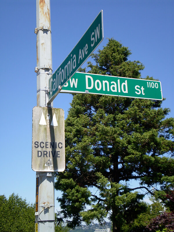
Sign at corner of SW Donald Street and California Avenue SW, July 4, 2011. Photograph by Benjamin Lukoff. Copyright © 2011 Benjamin Lukoff. All rights reserved. University Street
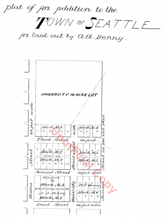
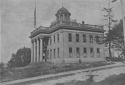
University Street was established as part of the Plat of an Addition to the Town of Seattle as Laid Out by A.A. Denny on November 16, 1861. It was named for the Territorial University of Washington, which had opened 12 days earlier on a 10-acre site atop “Denny’s Knoll.”

Plat of an Addition to the Town of Seattle as Laid Out by A.A. Denny, November 16, 1861 
Territorial University of Washington on opening day, November 4, 1861 Even though the University of Washington moved to its current location on Portage and Union Bays in 1895, the name was not changed. Nor did the university relinquish the land, though not for lack of trying. This turns out to have been fortunate. The UW owns the Metropolitan Tract to this day, and it earned $25 million in rent on the property during fiscal year 2020 alone.
The street, which originally ran from Front Street (now 1st Avenue) to the university campus, just northeast of 3rd Avenue, today begins at Alaskan Way on the Elliott Bay waterfront, and makes it just one block, to Western Avenue, before it becomes the Harbor Steps. From 1st Avenue, it’s about a third of a mile to 7th Avenue, where University Street is blocked by Interstate 5. It resumes at 9th Avenue and goes for another third of a mile to Boylston Avenue.

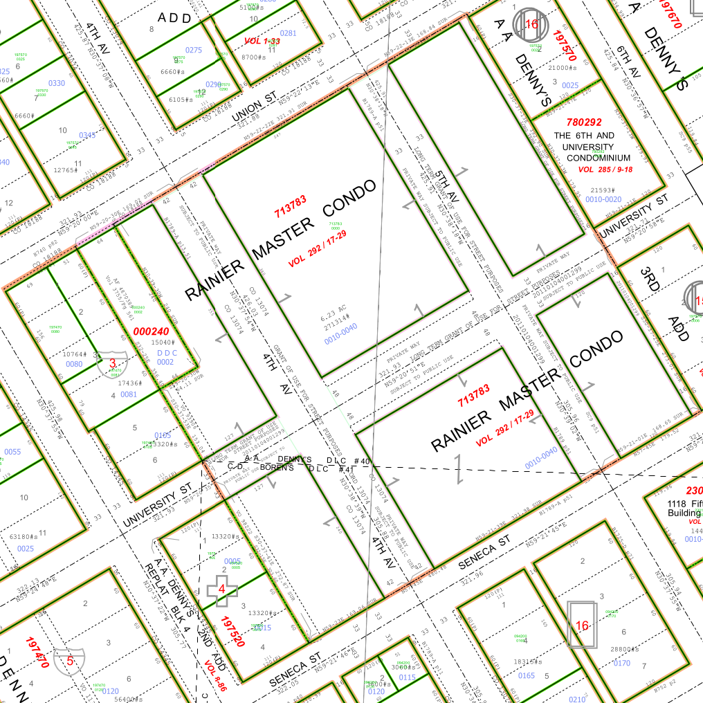
Portion of King County quarter section maps covering Metropolitan Tract Incidentally, you’ll notice in the map above that 4th and 5th Avenues between Seneca and Union Streets, as well as University Street between 4th and 5th Avenues, plus half a block on either end, are marked private way subject to public use — long term grant of use for street purposes. This fact — that the University of Washington still owns all the land within the Metropolitan Tract and never formally dedicated those streets to the public — was something I never knew until I started taking close looks at King County’s quarter section maps as part of my local history research. It might seem an academic distinction, but as The Seattle Times reported in 2015, there are very real financial consequences.
In 2008… the UW wanted the city to interpret the tract as one undivided lot, streets and all. That novel argument would benefit the UW in calculating the development footprint, or base.… The bigger the base, the logic went, the more square footage a developer could build before triggering affordable-housing fees under the city’s formula.… The university held a heavy hammer in negotiations. Because the UW owned development rights for the land under Fifth Avenue and University Street, it could make the city compensate it, one way or another, for using those streets.
Cherry Street
Cherry Street was among the first streets platted in Seattle on May 23, 1853. Sophie Frye Bass, author of Pig-Tail Days in Old Seattle, writes:
I choose to think that Cherry Street is named for the little town of Cherry Grove, Illinois — Mother’s birthplace — where the Dennys started on their long journey over the Oregon Trail.
“Mother,” in this case, refers to Louisa Catherine Denny Frye, one of three children of Arthur Armstrong Denny and Mary Ann Boren Denny of the Denny Party. She was 7 years old when they landed at Alki Point in November 1851.
In 2006, Hunter Brown wrote a People’s History essay for HistoryLink, “Finding Cherry Grove,” detailing his efforts to locate Cherry Grove, whose name was later changed to Cedar Township. The nearest town today is called Abingdon.
Bass began her Pig-Tail Days piece on Cherry Street by calling it “another up-and-up street… with no interferences. It begins at First Avenue, goes east and ends at Thirty-seventh avenue.” This is no longer quite the case because of a very small gap at the south end of the Seattle University campus. Today, Cherry begins at 1st Avenue and ends a block east of Broadway. It starts up again a couple hundred feet to the east as a continuation of the James Street/E James Way arterial, and then does go on to 37th Avenue in Madrona. All told it is 2⅓ miles long.
Bitter Place N
This street runs a tenth of a mile along the Bitter Lake waterfront from N 134th Street to the grounds of Broadview-Thomson K-8 School and Bitter Lake Playground. It was established in 1923 as part of Bitter Lake Villa Tracts.
Bitter Lake itself was so named because, as HistoryLink puts it, “A small, lake-bound sawmill operation at the southwest corner of Bitter Lake contracted with the Puget Mill and Brown Bay Logging Company to process their lumber cut from nearby forests. The tannic acid from logs dumped into the lake was so bitter that horses refused to drink from it, thus giving the 20-acre pond its name.” Its native name is čʼalqʼʷadiʔ, meaning ‘blackcaps on the sides’.
E Foster Island Road
This street, which runs about ¼ mile from Lake Washington Boulevard E to the beginning of the Foster Point Trail, all within the Washington Park Arboretum, was without a name until 1968, when it was named for the island in Union Bay to which it led. (It remained unsigned until a few decades later, however. There was no sign at the intersection until at least the 1990s, as I know since my parents’ house was at the south end of the Arboretum and I drove or biked by there weekly, if not more often, while I was growing up.)
Foster Island is known by the Duwamish tribe, who once used it as a burial ground, as Stitici, or ‘little island’. It was named by the settlers for Joel Wellington Foster, who came to Washington in the 1870s from St. Joseph, Missouri. He is said to have donated the island to the city in one HistoryLink article, but another says the city bought it in 1917.
W Marina Place
This street, established in 1991 as part of the development of the Elliott Bay Marina at the southern foot of Magnolia Bluff, runs ⅖ of a mile west from 23rd Avenue W to just shy of the 30th Avenue W street end beach.
While the origin of its name may not be interesting, the story of its establishment is a bit more so:
- The marina itself began the permitting process in 1983, but lawsuits delayed its creation for nearly a decade. The Muckleshoot Indian Tribe and Suquamish Tribe sued to block its construction on the basis that “construction of the Marina would eliminate a portion of one of their usual and accustomed fishing areas in Elliott Bay and thus would interfere with their treaty right to fish at the Marina site.” Homeowners on the bluff above intervened on the side of the developers, as “the area has had numerous major landslides that have left several homes at the crest of the bluff at risk and have repeatedly caused breaks in a trunk sewer line located at the base of the bluff.… The Marina construction includes the placement of 500,000 cubic yards of fill at the toe of the bluff, which would stabilize the area.” Eventually, a settlement was reached, which “calls for ongoing fisheries-related expenses paid to the tribe, which will be funded by a percentage of the moorage income.… [the] ‘Indian Treaty Surcharge.’”
- I believe this was the last major fill operation within Seattle city limits. Such a development would be all but unthinkable today.
- The marina was built on tidelands where W Lee Street and Puget Avenue W were platted but never built. They were vacated and W Marina Place was established. When it came to naming the access road, the developers originally proposed W Marina Boulevard, contending that as the road fell between the W Oakes Street right-of-way and the former W Lee Street right-of-way, it wasn’t a violation of the city’s principle of maintaining street grid names as much as possible. This was initially rejected by the city, which preferred W Lee Street, but after further discussion, W Marina Place was settled on. An interesting point the developers made was that as W Lee Street had never physically existed in Magnolia, though it had been platted there, calling the access road W Lee Street could actually be confusing, as “people familiar with Seattle streets know that there is no W Lee Street on Magnolia. Rather, they know W Lee Street as being on Queen Anne Hill.” Still, though, I have to believe they were more interested in their own vanity — Marina Boulevard? — than any particular concern for folks’ ability to navigate.
- For some reason, the public street ends just feet from the 30th Avenue W street end beach. I’m not entirely sure why that is; I don’t think the marina is opposed to public access to the beach; otherwise, they wouldn’t be in favor of the Magnolia Trail project, which would connect W Marina Place to W Galer Street, 32nd Avenue W, and thence to Magnolia Village.


Elliott Bay Marina site, 1930s and today University Way NE
This street runs 1¼ mile from NE Pacific Street in the south to NE Ravenna Boulevard and Cowen Park in the north. Until 2001, it was a block longer, starting farther south at NE Boat Street, but that portion was vacated as part of the development of the University of Washington campus.
Originally Columbus Avenue and then 14th Avenue NE, it was renamed University Way in 1920 after the University of Washington, which had moved to the neighborhood from its original home downtown in 1895. As local historian Paul Dorpat explains in this HistoryLink essay,
[In 1919] the University Commercial Club… ran [a contest] to rename 14th Avenue…. Club member Arthur Quigley’s “University Way” won the street name contest easily. To deflect any charges that the contest was fixed, Quigley donated the prize money to charity.
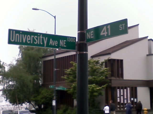
Even though it’s been a “way” for 101 years now, to locals University Way has always been, and always will be, “The Ave.” And that in itself will always cause some confusion, as this street sign demonstrates.

Even the city gets street names wrong sometimes. Photograph by Benjamin Lukoff, May 23, 2008. Copyright © 2008 Benjamin Lukoff. All rights reserved. Portage Bay Place E
This street, which runs ³⁄₁₀ of a mile from Fuhrman Avenue E to E Allison Street, was established as an alley in 1890 as part of the Denny–Fuhrman Addition to the City of Seattle, but only received a name in 1936. It was named for Portage Bay, the eastern arm of Lake Union, which it parallels. Portage Bay was in turn named for the portage from Union Bay (part of Lake Washington) to Lake Union over the Montlake Isthmus, which is today the Montlake Cut of the Lake Washington Ship Canal.
