
This street, created in 1919 by Ordinance 39638, is named for W Marginal Way SW. It begins there and goes just under 800 feet northwest to a dead end underneath the West Seattle Bridge. The Duwamish Trail continues on from there to the West Seattle Bridge Trail, while the 18th Avenue SW stairway heads south up the hill to SW Charlestown Street in Pigeon Point.
Tag: West Seattle
SW City View Street
This street was created in 1905 as part of the Steel Works Addition to West Seattle by Albert C. Phillips. Originally Cityview Street, it formed a trio with Grandview Street and Bayview Street, which are today SW Hinds Street and SW Spokane Street, and was named for its view of Seattle, to the northwest across Elliott Bay.
SW City View Street begins at 35th Avenue SW as a driveway and foot path which becomes a paved street just before 34th Avenue SW and extends just beyond, about 325 feet in all. The right-of-way continues through a greenbelt, and the road picks up at again at SW Admiral Way, where it goes 500 feet east to end at 30th Avenue SW.
SW Maryland Place
This short West Seattle street was created along with Elm Place SW as part of the 1888 First Plat of West Seattle by the West Seattle Land and Improvement Company. Originally Courtland Street, it became joined to Maryland Street when the latter was created as part of the 1895 Seattle Tide Lands plat. When West Seattle was annexed to Seattle in 1907, both were renamed Maryland Place.
(The tideland streets in West Seattle were, with a few exceptions, named after states: Illinois, [New] Hampshire, Arkansas, [New] Jersey, Rhode Island, [New] Mexico, Maryland, Louisiana, Georgia, [North and South] Carolina, Florida, Mississippi, Oregon, [North and South] Dakota, and Idaho. Of the ones confined to West Seattle, only Maryland remains [Florida, Oregon, Dakota, and Idaho also, or only, appear east of the West Duwamish Waterway].)
Today, SW Maryland Place begins at Elm Place SW and goes around 130 feet northeast to Harbor Avenue SW.

The Stone Cottage, corner of SW Maryland Place and Harbor Avenue SW, December 31, 2020. The campaign to save the building succeeded, and it was moved into storage on August 18, 2021. Photograph by Flickr user Mark Ahlness, licensed under Creative Commons Attribution-NonCommercial-NoDerivs 2.0 Generic Elm Place SW
This short West Seattle street was created as part of the 1888 First Plat of West Seattle by the West Seattle Land and Improvement Company. Originally Elm Street, it had companions in Oak, Maple, and Laurel Streets, none of which survive.
Elm Place SW begins at SW California Place and goes 300 feet southeast to SW Maryland Place, paralleling Harbor Avenue SW just over 100 feet to its northeast.
Wickstrom Place SW
This street is named for Peter Wickstrom (1837–1915), who immigrated to the United States from Sweden in the late 1860s. According to Thomas Ostenson Stine’s Scandinavians on the Pacific, Puget Sound, he lived in St. Paul, Minnesota, and Portland, Oregon, before coming to Seattle. His obituary, which ran in The Seattle Times on January 15, 1915, the day after his death, reads in part:
Peter Wickstrom, well-known pioneer of Seattle and an extensive realty holder, died unexpectedly yesterday afternoon after leaving the dinner table at his residence near Alki Point.… The deceased made his home at “The Old Homestead,” a tract of land not far from Alki Point.… Wickstrom came to this city in 1873 and conducted a hotel prior to the fire of 1889. Subsequent to that time he had not engaged actively in business.

Peter Wickstrom, from his Seattle Times obituary Wickstrom Place SW begins at 54th Place SW just south of Alki Avenue SW and goes around 500 feet south to a dead end.

The Peter Wickstrom tract in Baist’s 1912 atlas of Seattle The Peter Wickstrom tract in Kroll’s 1920 atlas of Seattle
Peter Wickstrom’s 7.18-acre tract before and after his death. Boyd Place SW
This West Seattle street was created in 1920 as part of Sarah M. Boyd’s First Addition to the City of Seattle. I believe Sarah Maria Loudenback Boyd (1853–1932) to be the Sarah M. Boyd in question here.
Boyd Place SW begins at 59th Avenue SW and SW Charlestown Street and goes around 425 feet southeast to Chilberg Place SW and Aikins Avenue SW.
Chilberg Avenue SW
This West Seattle street was created in 1889 as part of Chilberg’s Addition to West Seattle, filed by Swedish immigrants Nelson Chilberg (1840–1928) and his wife, Matilda Charlotta Schanstrom Chilberg (1846–1927). The Chilbergs started out as farmers and grocers before developing real estate interests.

Matilda Chilberg 
Nelson Chilberg
Matilda and Nelson Chilberg. Her photo is from the July 17, 1927, issue of the The Seattle Times; his is from the December 15, 1928, issue of the Seattle Post-Intelligencer. Chilberg Avenue SW begins at 59th Avenue SW and SW Carroll Street and goes ⅕ of a mile southeast to SW Genessee Street just east of Beach Drive SW at the Emma Schmitz Memorial Overlook and Me-Kwa-Mooks Park.
Clarmar Place SW
This West Seattle street is really more of a footpath, being narrow, unpaved, and closed to motor vehicles. The public right-of-way runs about 450 feet northwest from Bonair Drive SW as it descends through the Duwamish Head Greenbelt from Sunset Avenue SW to Alki Avenue SW, and the path continues for some 1,150 feet more through property owned by the parks department.
Clarmar Place SW was created in 1941 as part of the plat of Clarmar Crags, which name appears to be a combination of Clara Coumbe (died 1975?), landowner, and mar, for its location above Elliott Bay and Puget Sound.
S Spokane Street
I haven’t posted in a couple of weeks because I’ve been in Spokane, visiting my wife’s family for the holidays and attending the memorial service of my sister-in-law, may her memory be for a blessing. Since there is no Emily Street in Seattle, why not return, then, with a post on Spokane Street?

S Spokane Street looking west from 1st Avenue South, July 5, 2013. Photograph by Flickr user Curtis Cronn, licensed under Creative Commons Attribution-NonCommercial-NoDerivs 2.0 Generic. The barcodes on the support columns for the Spokane Street Viaduct was, in the words of the artwork’s creators, Claudia Reisenberger and Franka Diehnelt, intended “to ‘label’ the many layers that constitute SoDo’s history”; the word visible at upper left, ‘slóóweehL’, is a Lushootseed-language word that, according to Coll Thrush, author of Native Seattle: Histories from the Crossing-Over Place, “refers to channels, or ‘canoe-passes’, in the grassy marsh through which canoes can be pushed to effect a shortcut,” and was a Duwamish place name referring to what is now approximately 4th Avenue S and S Spokane Street. (Incidentally, this is the same word rendered as sluʔwiɫ in the IPA-based Lushootseed alphabet, which was also used as a name for what is now University Village, and is now the official name of a street on the University of Washington campus.) Spokane Street appears to have been created in 1895 as part of the Seattle Tide Lands plat. Streets in this plat that were not extensions of already existing ones, such as Commercial Street, were named after letters of the alphabet, American cities, American states, prominent local politicians, and places in Washington. The letters of the alphabet and the American cities appear in alphabetical order, but the states appear neither in alphabetical nor geographic order, and the places in Washington do not appear to be in any order whatsoever (except that a number beginning with Q are physically clustered together). They are as follows, listed alphabetically:
* Still exists
(I leave out West Point Avenue [which still exists, but only as a paper street] and Seattle Boulevard [now Airport Way S and Diagonal Avenue S] because the former was named for its proximity to West Point and the latter, it seems, for its prominence.)
It isn’t a list entirely composed of cities, islands, peninsulas, lakes, or rivers… the only things I notice are ⅔ of them are in Western Washington, with Chelan, Klickitat, and Wenatchee being in Central Washington and Spokane being in Eastern Washington; plus half the Western Washington locations (those beginning with Q) are on the Olympic Peninsula. It seems what is today Spokane Street could just as easily have been something else, and what is today such a prominent street wasn’t purposefully named after what was then the state’s third largest city (today, it ranks second).

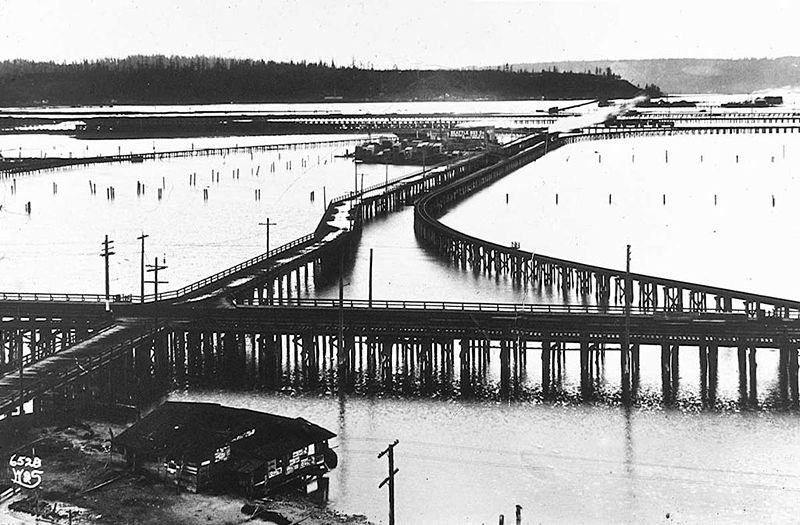
Trestles over the Elliott Bay tideflats, 1905. Photograph by Ira Webster and Nelson Stevens. According to the Wikimedia Commons entry for a similar photograph, the trestle in the foreground, running right to left (north to south), is today’s Airport Way S; the parallel trestle in the distance is 4th Avenue S; and running perpendicular from lower left to upper right (east to west, toward West Seattle) is S Spokane Street. The Seattle Box Company plant is visible at 4th and Spokane. 
A modern view of the Industrial District, Harbor Island, and West Seattle from above Beacon Hill, August 15, 2010. Photograph by Flickr user J Brew, licensed under Creative Commons Attribution-ShareAlike 2.0 Generic. The freeway in the foreground, running right to left (north to south), is Interstate 5. Airport Way S is visible just west of the freeway. The Spokane Street Viaduct and West Seattle Bridge can be seen at left heading from Beacon Hill to West Seattle. 4th Avenue S is still a major arterial, though it isn’t nearly as prominent in this photograph as the one taken 105 years earlier. Today, SW Spokane Street begins in West Seattle at Beach Drive SW, ½ a mile southeast of Alki Point, then goes nearly ½ a mile east to Schmitz Park, the block between 61st Avenue SW and 60th Avenue SW being a stairway. It resumes on the other side of the park at 51st Avenue SW and goes another ½ mile to 42nd Avenue SW. After a few interrupted segments between 35th Avenue SW and 30th Avenue SW, including another stairway, it begins again in earnest at Harbor Avenue SW and SW Admiral Way. From here it goes a full 2¼ miles east to Airport Way S, crossing the Duwamish Waterway and Harbor Island on the Spokane Street Bridge, and for this entire length runs either underneath or in the shadow of the West Seattle Bridge or the Spokane Street Viaduct, the latter of which leads to S Columbian Way on Beacon Hill.
After a short segment between Hahn Place S and 13th Avenue S, S Spokane Street begins again at 14th Avenue S and S Columbian Way and goes ⅔ of a mile east to 24th Avenue S. With the exception of an even shorter segment hanging off 25th Avenue S north of the Cheasty Boulevard greenspace, it next appears in Mount Baker, where it runs for two blocks between 33rd Avenue S and 35th Avenue S (part of this being stairway); then two more blocks between 36th Avenue S and York Road S (featuring another stairway); and two final blocks between 37th Avenue S and Bella Vista Avenue S.

Portion of 1895 plat of Seattle Tide Lands showing Spokane Avenue, now Spokane Street. The visible portion of Seattle Boulevard is now Diagonal Avenue S, and Whatcom Avenue is E Marginal Way S. Portions of Chelan Avenue, Klickitat Avenue, and Duwamish Avenue still exist, as do Oregon Street, Dakota Street, Idaho Street, Colorado Avenue, and Utah Avenue. Sunset Avenue SW
I enjoy writing posts on streets like W Commodore Way (I believe I am the first to have accurately identified its namesake), Division Avenue NW (I show that, even though it doesn’t divide anything from anything else today, it once served as Ballard’s eastern city limit for a few blocks), Loyal Avenue NW (I discover that it’s named not for the concept of loyalty, but for a baby girl whose first name was Loyal), and sluʔwiɫ (the University of Washington’s new Lushootseed-language name for Whitman Court). But sometimes I just like knocking something out quickly (I’m looking at you, W View Place and View Avenue NW). Sunset Avenue SW is another one of those. It originated in the 1888 First Plat of West Seattle by the West Seattle Land and Improvement Company, and the name simply refers to the street’s western view of Puget Sound; Vashon, Blake, and Bainbridge Islands; the Kitsap Peninsula; and the Olympic Mountains.
Sunset Avenue SW begins as a stairway at California Avenue SW, just across the street from Hamilton Viewpoint Park. Once the roadway begins up the hill, it goes ⅘ of a mile southwest to a dead end at the College Street Ravine southwest of 50th Avenue SW.
Schmitz Boulevard
This road, and the park through which it runs, Schmitz Park (or Schmitz Preserve Park), was named for German immmigrants Ferdinand Schmitz (1860–1942) and his wife, Emma Althoff Schmitz (1864–1959). Ferdinand was a banker, city councilman, and parks commissioner. He and Emma donated land — mostly, though not entirely, old-growth forest — to the city in 1908, forming the core (just over 55%) of the present park.
The Schmitzes had four children: Dietrich, Henry, Emma Henrietta, and Ferdinand Jr. A banker, Dietrich (1890–1969) became president of Washington Mutual in 1934 and retired as chairman of the board two years before his death. He was also a member of the Seattle School Board from 1928 (or 1930; sources differ) to 1961. Henry (1892–1965) was president of the University of Washington from 1952 to 1958. Schmitz Hall, the university’s administration building on NE Campus Parkway, was named in his memory in 1970.
Schmitz Boulevard looking north toward SW Stevens Street and SW Admiral Way. September 2007. Photograph by Joe Mabel, Wikimedia Commons, licensed under Creative Commons Attribution-ShareAlike 3.0 Unported According to the Friends of Seattle’s Olmsted Parks,
The roadway was originally envisioned as a continuation of the West Seattle Parkway, never realized, which would have connected Alki Beach to Lake Washington via a series of parkways. The built section is instead a short road that provided the only automobile entry to Schmitz Park, extending through an allée of trees and terminating at a pergola and shelterhouse.

Map of proposed West Seattle Parkway, cropped from a 1928 map showing both existing (red) and proposed (red hatched) park features. Schmitz Park and Boulevard are at upper left. Courtesy of the Seattle Municipal Archives, Identifier 2333. The portion between 59th Avenue SW and 58th Avenue SW in front of Alki Elementary School having been closed in 1949, Schmitz Boulevard today begins at 58th Avenue SW and SW Stevens Street and goes not quite half a mile east, then southeast, then north, to SW Admiral Way and SW Stevens Street. It is closed to automobile traffic.

Emma Schmitz Ferdinand Schmitz
Emma and Ferdinand Schmitz. Her photo is from the December 24, 1959, issue of the Seattle Post-Intelligencer (she had died December 23); his is from the August 23, 1942, issue of The Seattle Times (he had died August 21). Puget Boulevard SW
Puget Boulevard is a curious street, for a number of reasons:
- The paved portions are only a few blocks long — hardly comparable to, say, Lake Washington Boulevard or Magnolia Boulevard;
- Both east–west and north–south portions are called Puget Boulevard SW, contrary to the rule that directional designations precede street names for east–west streets (this is why Lake Washington Boulevard E becomes E Lake Washington Boulevard when it curves west on its approach to Montlake Boulevard E);
- Despite its name, it has no view of Puget Sound, sitting as it does in the Longfellow Creek valley in the Delridge neighborhood of West Seattle;
- And, as it turns out, it isn’t even named for Puget Sound, as might be expected, but rather for the Puget Mill Company (later part of Pope & Talbot and today part of Rayonier).
The Puget Mill Company, which once owned large swaths of land in the city (including what became the Washington Park Arboretum and the Broadmoor Golf Club), made two donations to the city in 1912, according to the Ninth Annual Report of the Board of Park Commissioners:
- “A rugged tract of logged-off land south of Pigeon Point and Youngstown in the large unplatted area” (20.5 acres — this became Puget Park); and
- “A strip of land 160 feet in width extending from Sixteenth Avenue Southwest and Edmonds Street (sic) to Thirty-fifth Avenue Southwest and Genessee Street, a distance of 8,500 feet, and comprising an area of about fifteen acres for parkway purposes. Under the conditions of this gift improvement work must be undertaken within five years. This acquisition forms an important link in the contemplated boulevard to West Seattle.”
This strip is today’s Puget Boulevard SW. Two things become apparent when looking at the King County Parcel Viewer map of West Seattle:
- Almost the entire right-of-way still exists;
- But less than ½ a mile of it is improved; most of it runs through Puget Park, the West Seattle Golf Course, and West Seattle Stadium.
Map of Puget Boulevard, from King County Parcel Viewer Once past the present site of West Seattle Stadium, the “contemplated boulevard to West Seattle” was to have run, as the Friends of Seattle’s Olmsted Parks puts it,
[Across] California Avenue a few blocks north of [the] present-day Alaska Junction, at that time part of the “Boston Subdivision.” It would have then headed northwest and down a ravine, eventually turning southwest to terminate at Alki Point.
Map of proposed West Seattle Parkway, cropped from a 1928 map showing both existing (red) and proposed (red hatched) park features. Puget Park and Boulevard are at lower right. Courtesy of the Seattle Municipal Archives, Identifier 2333. Returning to the question of the name — the Puget Mill Company was, of course, named after Puget Sound, which itself was named in 1792 by Captain George Vancouver of HMS Discovery for Lieutenant Peter Puget (1765–1822).
Today, the paved portion of Puget Boulevard SW begins at 23rd Avenue SW, about 1⁄10 of a mile north of SW Hudson Street, and goes ⅕ of a mile south to a dead end. After a very short section — not more than 150 feet long — east of Delridge Way SW, which serves as a driveway for a complex of townhouses, it resumes west of a foot path off Delridge and goes about 1⁄10 of a mile west to 26th Avenue SW. Along this stretch, there are houses to the north and the Delridge P-Patch and Puget Boulevard Commons to the south.
Point Place SW
This street, which was created in 1936, was named after Alki Point. Alki Avenue SW runs southwest from Duwamish Head to about 450 feet northeast of the point, where it turns south for a block and then becomes Beach Drive SW; Point Place continues another 200 or so feet toward Alki Point.
Alki Point Lighthouse, May 4, 2011. The first light here was supposedly hung in the 1870s; the U.S. Lighthouse Board installed an official one in 1887. The present lighthouse was built in 1913 and automated in 1984. Access is from Alki Avenue SW rather than Point Place SW. Public domain photograph by U.S. Coast Guard Chief Petty Officer Robert Lanier. 
Arthur Armstrong Denny (1822–1899), the leader of the Denny Party that landed at Alki Point on November 13, 1851, helped build this cabin. Most of the party moved to what is now Pioneer Square the next spring. Photograph by Frank LaRoche, no date (though no later than 1891, when the cabin, shown here in ruins, was demolished). 
Aerial view of West Seattle, March 17, 2009. Alki Point is in the lower-left-hand (west) corner; Duwamish Head is in the upper-left-hand (north) corner. The green spaces in the foreground, from left to right (north to south), are the Duwamish Head Greenbelt, Schmitz Preserve Park, and Mee-Kwa-Mooks Park. Elliott Bay lies north and east of Alki Point; the rest of the water is Puget Sound. Public domain photograph by Dcoetzee, Wikimedia Commons. Alki Avenue SW
The settlement at Alki Point established by the Denny Party in 1851 was originally named New York. By a process that is not entirely clear, the name became New York–Alki, and then just Alki. Alki means ‘by and by’ or ‘someday’ in Chinook Jargon, the implication being that the settlement might rival New York… someday. Charles C. Terry officially applied the Alki name to the town plat he filed in 1853, and the point, street, and neighborhood were all named after it.
In the introduction to her 1937 book, Pig-Tail Days in Old Seattle, Sophie Frye Bass writes:
Please everyone, pronounce Alki as the Indians did, as if it were spelled “Alkey.”
Hardly anyone does this anymore — in fact I don’t think I’ve ever heard someone say
/ælkiː/ in all seriousness when talking about West Seattle./ælkaɪ/ is by far the preferred pronunciation, as shown by this informal Twitter poll I ran:Seattleites! I’m willing to bet you’ve always pronounced Alki as AL-kye (ælkaɪ), never as AL-kee (ælkiː). So this poll isn’t about how YOU pronounce it, but rather how you’ve heard OTHERS pronounce it.
— (((Benjamin Donguk Lukoff))) (@lukobe) October 15, 2021Apparently the Denny descendants (Bass was the daughter of Louisa Catherine Denny, herself the daughter of Arthur Armstrong Denny and Louisa Catherine Boren) still prefer — nay, insist — on ALkee:
The Dennys insist on AL-kee
— Mossback (@KnuteBerger) October 15, 2021I was once at a talk where a Denny family descendant chastised the audience for saying Alkye, instead of the correct Al-kee Oh well
— David B. Williams (@geologywriter) October 15, 2021I think I’ve only heard AL-kee from presenters (Brewster Denny?). I listened to this recording of a Squamish elder speaking Chinook Jargon and that seems to be closest to his pronunciation. See 12:55 mark: https://t.co/dNgc7auFcu
— Zach Works (@Zach_Works) October 15, 2021
Birthplace of Seattle monument, 1926. Originally dedicated in 1905 on the 54th anniversary of the landing of the Denny Party at Alki Point, it reads “At this place on 13 November 1851 there landed from the Schooner Exact Captain Folger [and] the little colony which developed into the City of Seattle.” It was rededicated, with a new foundation, on September 4, 1926 (likely the date of this photograph). A stone from near Plymouth Rock, Massachusetts, was put in the foundation, and the new plaque reads “From Plymouth Rock to Alki Point: Honoring pioneers on the American shores of the Atlantic and Pacific Oceans, the above stone was brought from Plymouth Rock by the First Transcontinental Motorized Caravan, managed by James H. Brown, and endorsed by the American Automobile Association. This tablet was furnished by the Automobile Club of Washington. The unveiling ceremonies on September 4, 1926, was participated in by officers and citizens of. the City of Seattle, the County of King and the State of Washington.” Courtesy of the Seattle Municipal Archives, Identifier 46980 As noted in Harbor Avenue SW and Beach Drive SW, the Alki Avenue name once stretched from Lincoln Park around Alki Point and Duwamish Head to the industrial area near Harbor Island, but sometime between 1912 and 1920 the name was reduced to the portion between Alki Point and Duwamish Head.
Alki Avenue, July 4, 2005. Photograph by Flickr user Chas Redmond, licensed under Creative Commons Attribution 2.0 Generic Today, Alki Avenue SW begins at Harbor Avenue SW by Duwamish Head and goes 2⅕ miles southwest to Beach Drive SW.
Alki Beach, July 4, 2005. Photograph by Flickr user Chas Redmond, licensed under Creative Commons Attribution 2.0 Generic Beach Drive SW
Like Harbor Avenue SW, Beach Drive SW was once part of Alki Avenue SW. It became Beach Drive sometime between 1912 and 1920. In contrast to Alki and Harbor Avenues, most of Beach Drive’s beaches are private, though there is a long public stretch at the Emma Schmitz Memorial Outlook, as well as Lowman Beach Park at the south end.
Puget Sound shore looking northwest along Beach Drive toward Alki Point, August 2007. Photograph by Joe Mabel, Wikimedia Commons, licensed under Creative Commons Attribution-ShareAlike 3.0 Unported Beach Drive SW begins at Alki Avenue SW just south of Alki Point and goes just over 3 miles southeast to Trail #1 at Lincoln Park.

Signs along Beach Drive SW a little under 1,000 feet north of Lincoln Park. The park boundary sign is unofficial. Its placement appears to imply that the tail end of Beach Drive is private, which it’s not. Nor is the driveway (SW Othello Street) on the left. Photograph by Benjamin Lukoff, March 10, 2013. Copyright © 2013 Benjamin Lukoff. All rights reserved. Harbor Avenue SW
As noted in Alaskan Way, Harbor Avenue SW was once part of Railroad Avenue. When the Elliott Bay tidelands were platted in 1895, Railroad Avenue stretched from (using current landmarks) the Magnolia Bridge along the waterfront to the Industrial District, then across Harbor Island to West Seattle, ending southwest of Duwamish Head. In 1907 the West Seattle portion was renamed Alki Avenue, and sometime between 1912 and 1920 it was given its current name.

Looking northwest up what is now Harbor Avenue SW toward Duwamish Head, April 1902 Today, Harbor Avenue SW begins at SW Avalon Way and SW Spokane Street at the west end of the West Seattle Bridge and goes 1¾ miles northwest to Duwamish Head, where it becomes Alki Avenue SW.

Street sign at corner of Harbor Avenue SW and Alki Avenue SW, Duwamish Head, with Elliott Bay and downtown Seattle in background, October 2017. Photograph by Ron Clausen, Wikimedia Commons, licensed under Creative Commons Attribution-ShareAlike 4.0 International S Southern Street
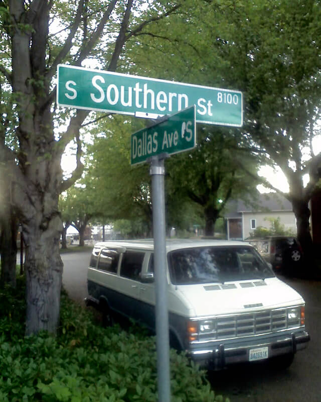
Having covered E North Street, Eastern Avenue N, and Western Avenue, we now come to S Southern Street! This street originated in the 1891 plat of River Park, filed by Alexander Prentice (1820–1909) and his wife, Jane Thomson Prentice (1823–1911). It appears to be so named simply because it is the southernmost street in the plat, half a block north of the 1890 plat of South Park.

Portion of River Park addition showing Southern Avenue (now Southern Street) S Southern Street begins just east of 12th Avenue S on the west bank of the Duwamish Waterway, and goes ½ a mile to just west of 7th Avenue S, where it is blocked by Washington State Route 99 (W Marginal Way S). (Its first tenth of a mile is within unincorporated King County as part of the “Sliver by the River.”) It begins again in West Seattle as SW Southern Street at 35th Avenue SW, and goes ⅗ of a mile to 44th Avenue SW.

Signs at corner of S Southern Street and Dallas Avenue S, May 20, 2013. Photograph by Benjamin Lukoff. Copyright © 2013 Benjamin Lukoff. All rights reserved. S Graham Street
This street was named for Walter Graham (1828–1919), who came to Seattle in 1853. Three years later, he married Eliza Mercer, second daughter of Thomas Mercer (Mercer Street, Mercer Island), though she unfortunately died six years later. With his third wife, Elizabeth Crammond (or Crommon), he had a daughter, Nellie, who later married David Thomas Denny II, son of early settler David Thomas Denny (Denny Way). Graham’s brother, David, came to Seattle four years after his brother, and was one of the city’s first schoolteachers. He ended up marrying Eliza Mercer’s sister, Susannah.
Graham sold some of his southeast Seattle land in 1865 to Everett Smith, who filed the plat of Brighton Beach in 1890 on which what was then Graham Avenue appeared. He once owned what is today Seward Park on Bailey Peninsula, which was previously known as Graham’s Peninsula.
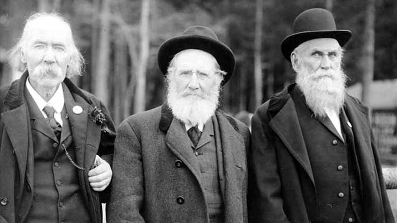
He was present at the Battle of Seattle in 1856, and is pictured below with fellow survivors Ira Woodin and Carson D. Boren (Boren Avenue).
Ira Woodin, Carson Boren, and Walter Graham at Alki Point, November 3, 1905 S Graham Street begins in the east at Wilson Avenue S and goes 2⅒ miles west to Swift Avenue S and 20th Avenue S, just east of Interstate 5. After a short segment between Corgiat Drive S and 16th Avenue S just west of the freeway, it next appears in West Seattle. Betwen 16th Avenue SW and 22nd Avenue SW, it alternates between roadway, stairway, and pathway, and there is a similar situation between 25th Avenue SW at Delridge Way SW and High Point Drive SW at Bataan Park. SW Graham Street begins again at High Point Drive SW and SW Raymond Street and goes 1¼ miles to its end at 50th Avenue SW,
S Lander Street
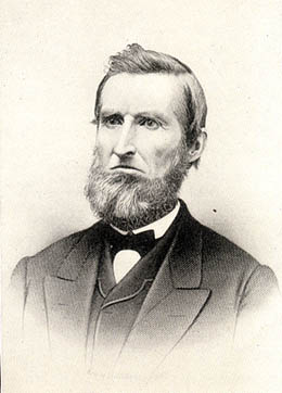
This street is named for Judge Edward Lander (1816–1907), chief justice of the territorial supreme court from 1853 to 1857. In 1855, he, along with Charles Terry, bought Carson Boren’s downtown land claim for $500. They subsequently donated two acres of land, along with Arthur Denny, who donated eight, to form the first campus of the University of Washington, which opened in 1861. The university owns the Metropolitan Tract to this day, though it moved to its present location in 1895. Lander’s name also appears on Lander Hall, a UW dormitory on NE Campus Parkway.

Edward Lander SW Lander Street begins at 59th Avenue SW in the Alki neighborhood of West Seattle, and goes ⅕ of a mile to 55th Avenue SW. It resumes just to the south at S Lander Place and goes a further ⅛ of a mile to SW Admiral Way. Picking up again at 50th Avenue SW, it makes it ½ a mile to Walnut Avenue SW before being interrupted again, as happens to so many West Seattle streets because of the varying topography. There is a final ¼-mile stretch in West Seattle from 39th Avenue SW to 36th Avenue SW, then a very short segment on Harbor Island before S Lander Street resumes in the Industrial District at Colorado Avenue S and goes ¾ of a mile east to Airport Way S. On Beacon Hill, Lander begins just west of 13th Avenue S and goes ⅔ of a mile to just past 23rd Avenue S, including the block-long stretch that is now known as S Roberto Maestas Festival Street. Lander begins again at 30th Avenue S in Mount Baker and goes a final four blocks to 34th Avenue S.
S Hanford Street
This street is named for Edward Hanford (1807–1884) and his wife, Abigail Jane Holgate (1824–1905), who left Iowa in the early 1850s to settle adjacent to Abigail’s brother, John (namesake of S Holgate Street), on what is today known as Beacon Hill but was known from then until the early 1890s as Holgate and Hanford Hill. Edward and his family were loggers, then orchardists, and unlike John Holgate, he went on to develop his donation claim.
The Hanfords’ son Clarence (1857–1920) founded, with James D. Lowman, the Lowman & Hanford Stationery and Printing Company in 1885. The firm went out of business in the 1960s, but their Pioneer Square building still, the last time I drove by, had a sign painted on it reading “Seattle’s Oldest Retail Company,” which it very well might have been when it closed. Their son Thaddeus (1847–1892) was for a time the owner of the Daily Intelligencer newspaper, predecessor of the Seattle Post-Intelligencer. And their son Cornelius (1849–1926), a federal judge from 1890 to 1912, was earlier a territorial legislator, Seattle city attorney, and chief justice of the Washington Supreme Court. He is the namesake of Hanford, Washington, and by extension the Hanford Site, which produced the plutonium used in the first nuclear explosion and the bombing of Nagasaki. He was also the author of Seattle and Environs, 1852-1924.

Edward Hanford SW Hanford Street begins in West Seattle at SW Admiral Way and 59th Avenue SW and goes ¼ mile east to Schmitz Preserve Park at 56th Avenue SW. It begins again at 51st Avenue SW and goes nearly a mile east to 36th Avenue SW, becoming a stairway for the half-block east of 46th Avenue SW. After serving as little more than a driveway between SW Admiral Way and Fauntleroy Avenue SW, it next appears as S Hanford Street at E Marginal Way S, where it goes for ⅓ of a mile east to Occidental Avenue S. After a few short segments farther east in the Industrial District, Hanford begins again on Beacon Hill at 12th Avenue S and goes nearly a mile east to Rainier Avenue S, the segment between 25th Avenue S and Morse Avenue S being a stairway. It resumes a few blocks east at 30th Avenue S and finishes up ½ a mile east at Cascadia Avenue S.
S Holgate Street
This street is named for John Cornelius Holgate (1828–1868). Born in Ohio, he took the Oregon Trail west in 1847 and explored Elliott Bay and the Duwamish River by canoe in the summer of 1850. (The Seattle Times calls him “the first non-Indian of record to have done so.”) He returned to Oregon afterwards, however, and did not settle in what is now Seattle — specifically, Beacon Hill — until 1853, two years after the Denny Party landed at Alki Point. His mother, Elizabeth; brothers, Lemuel and Milton; and sister, Abigail, along with her husband, Edward Hanford (namesakes of S Hanford Street), soon followed. The Hanfords settled on the hill — known thereafter as Holgate and Hanford Hill until the late 1880s — adjacent to Holgate. (Milton was one of three whites to die in the Battle of Seattle in 1856, and was himself the cause of one of those deaths, having earlier shot Jack Drew, a deserting sailor from the USS Decatur, in a “friendly-fire” incident.)
A gold prospector, Holgate left for Idaho in 1863, and died there in 1868, the first casualty of the War Under the Mountain, a conflict between two rival gold mines in the Owyhee Desert, one of which he was part owner. According to Robert L. Deen, writing for True West magazine, there are conflicting accounts of Holgate’s death. The Owyhee Avalanche reported that:
Desperate fighting ensued during the charge…. John C. Holgate… one of the foremost in the advance, was shot in the head, and must have died instantaneously.
The Idaho Tri-Weekly Statesman had a slightly different story:
It appears that J.C. Holgate has been killed, some say assassinated, murdered — not killed in a fight, but shot through the head without provocation.
SW Holgate Street begins in West Seattle just west of 47th Avenue SW and goes ¼ of a mile east to California Avenue SW at Palm Avenue SW. There are two more short segments on the peninsula, between 41st Avenue SW and Arch Avenue SW and between Victoria Avenue SW and Brook Avenue SW. S Holgate Street resumes at Utah Avenue S and goes ¾ of a mile east to an overpass over Interstate 5, where it becomes Beacon Avenue S. There is a one-block stretch between 12th Avenue S and 13th Avenue S on top of the hill, and then Holgate goes a mile from the Beacon Hill Playfield at 14th Avenue S to 31st Avenue S at Colman Park, the half-block east of 16th Avenue S being a stairway and the block between 28th Avenue S and 29th Avenue S being unimproved. There is finally a short stretch east of Lakeside Avenue S at 36th Avenue S that essentially serves as a private driveway; it is a shoreline street end, but one not yet accessible to the public.
Lanham Place SW
Like SW Bataan Street, Lanham Place SW is part of High Point, originally developed by the Seattle Housing Authority in 1942 as defense housing and redeveloped in 2004. The name was originally applied to SW Lanham Way, and was preserved while some other names, including SW Snow Court, Cycle Lane SW, and MacArthur Court SW, were eliminated. It was named for Fritz G. Lanham, Texas congressman, who sponsored the Lanham Act that created the Defense Homes Corporation.
Today, Lanham Place SW begins at 32nd Avenue SW and SW Raymond Street and goes ¼ mile southeast to 31st Avenue SW, Sylvan Way SW, and SW Morgan Street.
SW Bataan Street
High Point, originally developed by the Seattle Housing Authority in 1942 as defense housing, was redeveloped in 2004. It was reconnected to the street grid, and as part of the process some street names, including SW Snow Court, Cycle Lane SW, MacArthur Court SW, and Bataan Place SW, were eliminated. (They are still visible in the city clerk’s geographic indexing atlas, which was created before the redevelopment and has not been updated.) No one appeared to care much about the loss of Snow, Cycle, or MacArthur (named for General Douglas MacArthur, who had recently evacuated to Australia when the fall of the Philippines seemed imminent).* The loss of Bataan, named for the World War II battle that took place on the Bataan Peninsula on the island of Luzon, was another story, however, and SW Eddy Street was quickly renamed SW Bataan Street, enabling the city to continue to “memorialize and honor the 10,000 American and Filipino soldiers who lost their lives in the Bataan death march.”
* See the August 7, 1943, Seattle Times article ‘City’s Wartime Additions Inspire Some Monickers’ for the story behind the street names in High Point, Rainier Vista, and other Seattle Housing Authority projects.
W Marginal Way SW
W Marginal Way SW, like its twin across the water, E Marginal Way S, began literally as a “marginal way” to “give railroads, street cars and other transportation facilities access to the Duwamish waterway.”
W Marginal Way SW begins at 26th Avenue SW at the Port of Seattle’s Terminal 5. From there, it’s 3 miles southeast to 2nd Avenue SW, by the south end of the 1st Avenue S Bridge. It resumes on the east side of the bridge as W Marginal Way S, an extension of Highland Park Way SW, and runs 4⅖ miles from there to the southern city limits. (For all but the first few blocks of this stretch, it is a limited-access highway carrying Washington State Route 99.) Beyond there it runs 3½ miles more to the vicinity of an interchange with Tukwila International Boulevard. The name is dropped at this point (and does not appear on signs south of the initial few blocks); the highway continues 1¾ miles as Washington State Route 599 to Interstate 5.

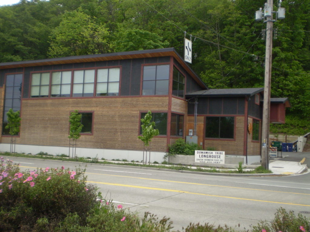
Duwamish Longhouse and Cultural Center, 4705 W Marginal Way SW, May 2010. Photograph by Benjamin Lukoff, originally appearing in Seattle Then and Now.
Copyright © 2010 Benjamin Lukoff. All rights reserved.W Marginal Way S is the location of the Duwamish Longhouse and Cultural Center, across the street from həʔapus Village Park and Shoreline Habitat (formerly Terminal 107 Park). həʔapus, or x̌əʔapus, was the name of a Duwamish village that was burned down by settlers in 1895. The new longhouse became the first one within city limits in 114 years. Notably, descendants of settlers Charles Terry and David Denny participated in fundraising and advocacy, without which the project would have been impossible, as the Duwamish were forced to purchase back the land. (A good article for more detail is “On the Duwamish River, a longhouse rises,” which appeared in Real Change in March 2009.)
S Front Street
Usually, a Front Street designates a city’s waterfront. Front Street in Philadelphia parallels the Delaware River; NW Front Avenue in Portland, Oregon, goes up the Willamette River; Front Street in Toronto runs along Lake Ontario. Seattle once had a prominent Front Street alongside Elliott Bay, but it was renamed 1st Avenue in 1895. The Front Street we do have runs a grand total of ⅖ of a mile split among three segments, and it runs east–west, while the nearby Duwamish River runs north–south. Why is this?
As it turns out, S Front Street — established as part of Joseph R. McLaughlin’s Water Front Addition to the City of Seattle in 1906 — did use to run along the river, before it was rechanneled beginning in 1913. (Here is an excellent post from the Burke Museum on the Duwamish meanders, with some great maps and aerials.) The maps below show its course along the Duwamish River Oxbow in 1912 (left) and its current landlocked state (right). You can still make out its former location, as well as small remnants in the form of the Slip 2 and Slip 3 inlets. (Incidentally, Front Street originally was shaped like a horseshoe — today’s S Front Street was originally North Front Street, and South Front Street is today S River Street.)

Speaking of the Oxbow, here’s an advertisement for it. So much for that “16,000 feet of deep water frontage.”

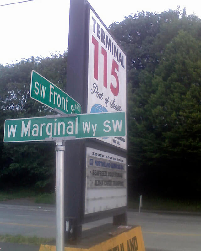
Advertisement for Oxbow in June 1, 1906, issue of The Seattle Times Today’s S Front Street begins at 6th Avenue S and goes ¼ of a mile west, ending just beyond 4th Avenue S. There is another 400-foot-long section between E Marginal Way S and 1st Avenue S, below the approach to the 1st Avenue S Bridge. And then there is one last 200-foot-long section on the west side of the Duwamish River — SW Front Street starts at W Marginal Way SW and ends at the entrance to the Port of Seattle’s Terminal 115 (which used to be Boeing Plant 1, the airplane manufacturer’s first production facility).
Incidentally, here’s a great article on the one in New Orleans I came across while looking up various Front Streets. It’s hard to beat a lede like this: “In a city replete with famed streets, scenic avenues and poetic street names, one particular artery excels at being obscure, nominally insipid, marvelously intermittent, and sometimes barely even a street.”
Sign at corner of SW Front Street and W Marginal Way SW, May 20, 2013. Photograph by Benjamin Lukoff. Copyright © 2013 Benjamin Lukoff. All rights reserved. Vashon Place SW
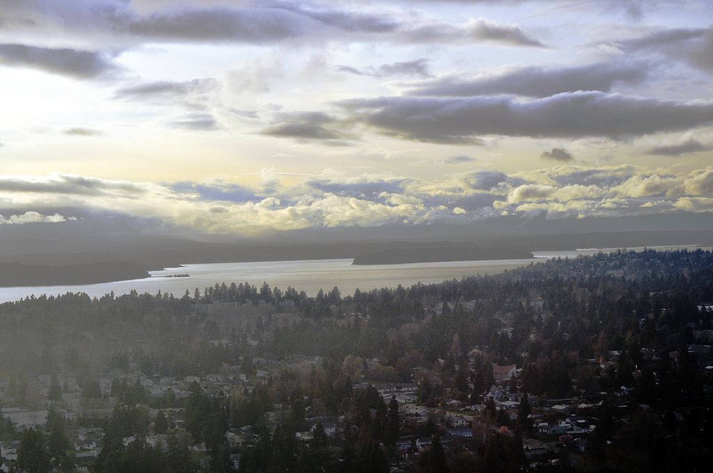
This street — just about 350 feet long, like its neighbor Blake Place SW — connects SW Othello Street to Fauntleroy Way SW just north of Solstice Park. Created as part of the Lincoln Home Addition in 1907 by builder Albert Eugene Felmley and his wife, Mabel L. Felmley, it is named after Vashon Island, located 4 miles to the southwest, across Puget Sound. The island itself was named for Royal Navy Admiral James Vashon by his friend, Royal Navy Captain George Vancouver, in 1792.
Two other streets in the Lincoln Home Addition are named for Puget Sound islands: the already-mentioned Blake Place SW, and Bainbridge Place SW.

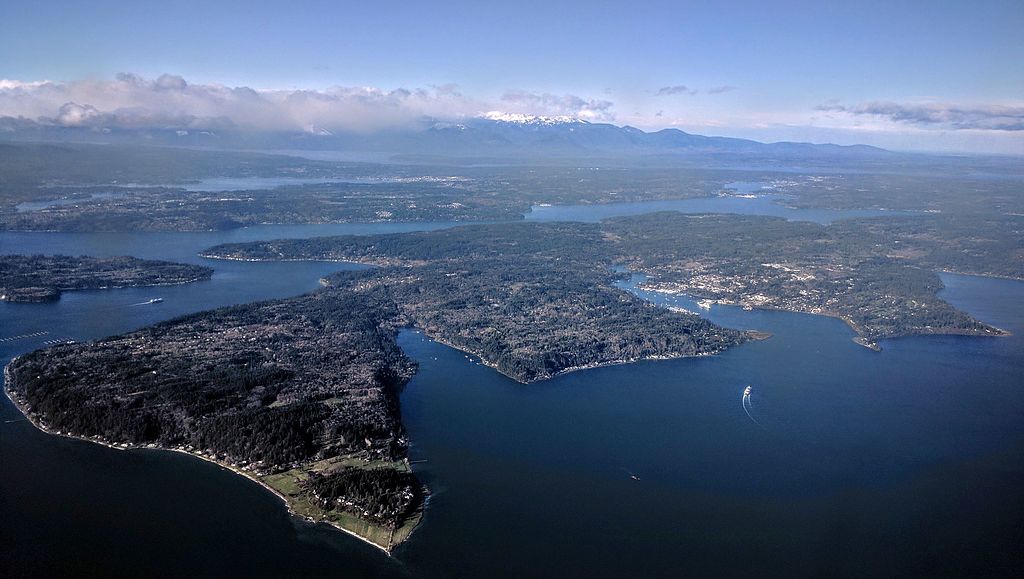
Aerial view of Vashon and Maury Islands from the northwest. Photograph by Flickr user Travis, licensed under Creative Commons Attribution-NonCommercial 2.0 Generic Blake Place SW
This 350-foot-long street connects SW Othello Street to SW Fontanelle Street just north of Solstice Park. It was created as part of the Lincoln Home Addition in 1907 by builder Albert Eugene Felmley and his wife, Mabel L. Felmley, and is named after Blake Island, located 4⅖ miles to the west, across Puget Sound. The island itself was named for U.S. Navy Commodore George Smith Blake, then head of the United States Coast Survey, by Charles Wilkes in 1841.
Two other streets in the Lincoln Home Addition are named for Puget Sound islands: Bainbridge Place SW and Vashon Place SW.

Aerial view of Blake Island from the east (West Seattle in foreground). Photograph by Joe Mabel, Wikimedia Commons, licensed under Creative Commons Attribution-Share Alike 3.0 Unported Bainbridge Place SW
This short street — not quite 275 feet long — connects SW Othello Street to Fauntleroy Way SW just north of Lincoln and Solstice Parks. Created as part of the Lincoln Home Addition in 1907 by builder Albert Eugene Felmley and his wife, Mabel L. Felmley, it is named after Bainbridge Island, located 5¼ miles to the northwest, across Puget Sound. The island itself was named for U.S. Navy Commodore William Bainbridge, commander of the USS Constitution, by Charles Wilkes in 1841.
Two other streets in the Lincoln Home Addition are named for Puget Sound islands: Blake Place SW and Vashon Place SW.

Aerial view of Bainbridge Island from the southeast. Photograph by Dicklyon, Wikimedia Commons, licensed under Creative Commons Attribution-Share Alike 4.0 International S Fontanelle Street
This fragmented street starts at Rainier Avenue S and travels two blocks west to 46th Avenue S. It makes its next appearance in Beacon Hill as a block-long street hanging off Military Road S, just east of Interstate 5. There are a few more blocks in South Park, from 5th to 2nd Avenues S, then half a block in West Seattle just west of California Avenue SW and a few final blocks from just east of Vashon Place SW to 47th Avenue SW at Lincoln Park. It is named for Fontanelle, Iowa, where Joseph and Catherine (Henderson) Dunlap (of S Henderson Street) lived before coming to Seattle in 1869.
S Henderson Street
This street is named for Catherine Henderson (1822–1891), wife of Joseph Dunlap (1818–1893), who gives his name to Dunlap Elementary School and the Dunlap section of Rainier Valley. HistoryLink writes of the couple, who came to Seattle from Fontanelle, Iowa:
Joseph and Catherine (Henderson) Dunlap arrived in the Puget Sound region in September 1869, having traveled by covered wagon from Iowa. According to family legend, when they arrived in the Puget Sound region, they followed a road over Beacon Hill and sent their son George up a tree to view the land to the south and east. There he spotted a flat valley and Lake Washington. The Dunlaps decided to homestead in that valley, located to the south of the Van Asselt and Mapel families. They claimed 120 acres extending east toward Rainier Beach.
It appears to have been Lake Street in the original Dunlap’s Plat of Land on Lake Washington (1889) but was likely changed when Rainier Beach was annexed to Seattle in 1907.
Today, S Henderson Street begins at Seward Park Avenue S, just west of Be’er Sheva Park, and runs ¾ of a mile west to Carkeek Drive S. On the other side of Interstate 5 and the Duwamish River, it runs ⁹⁄₁₀ of a mile through South Park from just east of 14th Avenue S to just west of 2nd Avenue S, the portion over Highway 99/W Marginal Way S being a footbridge. Once in West Seattle, SW Henderson Street runs ⅔ of a mile from 8th Avenue SW, just west of Westcrest Park, to 21st Avenue SW, where the arterial turns into SW Barton Place, and is then a two-block residential street from 22nd Avenue SW to 25th Avenue SW, where it is blocked by the Westwood Village shopping mall. On the other side of the mall, it’s ⅘ of a mile from 28th Avenue SW to SW Barton Street at Fauntleroy Park, and then a final couple of blocks from 43rd Place SW to Fauntleroy Way SW, just north of Washington State Ferries’ Fauntleroy Terminal.


.jpg)
.jpg)