Because its original location is covered by King County Metro’s Atlantic Base and Interstate 5, Judkins Street now starts on Beacon Hill just west of 12th Avenue S and goes around 850 feet east to just east of 14th Avenue S, where it becomes a stairway to 15th Avenue S. The unimproved right-of-way continues through a greenbelt to 16th Avenue S, where there exists a 100-foot stretch of Judkins before it is stopped by Sturgus Avenue S, Daejon Park, and Interstate 90. On the other side of I-90, it resumes at 20th Avenue S and goes ⅘ of a mile east to Lake Washington Boulevard S, the last 50 or so feet being a stairway. Between Lake Washington Boulevard S and Lakeside Avenue S, only the first 150 feet is improved, mainly serving as a driveway for two houses. And east of Lakeside Avenue S there is a very short stretch that, like its neighbor to the north, S Norman Street, turns into a shoreline street end on Lake Washington — one of Leschi’s String of Pearls.
Built on the site of a former ravine landfill that was used for about four decades, Judkins Park was transferred to the parks department in the late 1940s and early 1950s, and opened to the public on October 8, 1977, according to a story in the October 6 issue of The Seattle Times.
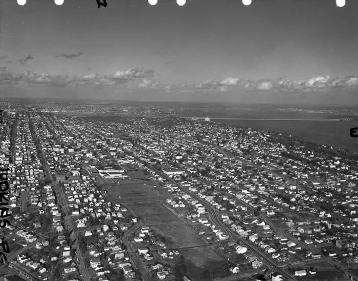
Aerial view of Judkins Park and Playfield, 1965. Courtesy of the Seattle Municipal Archives, Identifier 29470. S Judkins Street is at bottom center and right, below the park. Washington Middle School is at the north end of the park and 23rd Avenue S is the arterial to its east. Lake Washington and the Evergreen Point Floating Bridge (Washington State Route 520) are visible in the distance.
For the origin of S Norman Street, we go back to our first street name post, SW Seattle Street, which read in part:
On August 4, 1869, Ike M. Hall — the executor of the estate of Norman B. Judkins — filed the Judkin’s (sic) Addition to the Town of Seattle, located just southwest of where the interchange between I-5 and I-90 is today. From north to south, the east–west streets are named Norman, B, Judkins, Addition, Town, and Seattle.
Today, S Norman Street begins on the other side of Beacon Hill, the portion shown above having been obliterated by King County Metro’s Atlantic Base and Interstate 5. (In fact, S Addition Street is the only one remaining in its original location, Judkins Street now starting on Beacon Hill and Seattle Street only existing in West Seattle.) Beginning at Poplar Place S just east of Interstate 90, it goes for a block northeast to Rainier Avenue S. It picks up again at Davis Place S and S Bush Place and goes a block east to 21st Avenue S. Resuming at 22nd Avenue S, just east of Judkins Park (also named for Norman B. Judkins), it goes ⅗ of a mile east to 33rd Avenue S, with only two short interruptions:
An unimproved stretch south of St. Gebriel Ethiopian Orthodox Church between 26th Avenue S and Martin Luther King Jr. Way S: what looks to be a bramble patch followed by a driveway for some townhouses; and
A stairway from 31st Avenue S to half a block west of 32nd Avenue S.
There appears to be a privately maintained stairway from 33rd Avenue S down to Lake Washington Boulevard S, and the next block is completely unimproved, though in both cases neighbors appear to be incorporating the right-of-way into their yards and driveways. Finally, there is a short stretch of Norman Street east of Lakeside Avenue S that turns into a shoreline street end on Lake Washington — one of Leschi’s String of Pearls.
King County Parcel Viewer showing S Norman Street between 26th Avenue S and Martin Luther King Jr. Way S. What appears to be a private driveway from Martin Luther King is actually public right-of-way.King County Parcel Viewer showing S Norman Street from 33rd Avenue S to Lake Washington. The private driveway in the public right-of-way east of Lake Washington Boulevard S (center of image) is easily visible, as is the shoreline street end east of Lakeside Avenue S.
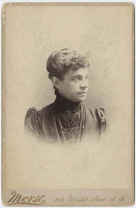
Undated daguerreotype portrait of Louisa Boren Denny
Today, E Louisa Street begins at Minor Avenue E and goes a block east to Yale Avenue E. It resumes half a block east at the alley west of Eastlake Avenue E and makes it 2½ blocks before being stopped by Interstate 5 at Boylston Avenue E. Resuming in the Montlake neighborhood just west of W Montlake Place E, it then goes ¼ mile east to 25th Avenue E.
This Magnolia street, which goes not quite 700 feet from 37th Avenue W just south of W Armour Street in the south to W Fulton Street just west of 36th Avenue W in the north, originated in 1939 as part of the plat of Carleton Park Terrace, an Addition to the City of Seattle, filed by C.F. Bishop, Jr., his wife, Elizabeth, and the city of Seattle itself, owners of the land in question.
Charles F. Bishop, Jr. (1881–1963) was — according to his Seattle Post-Intelligencer and Seattle Times obituaries, and based on information in his father’s Times obituary from 1943 — born in Brockport, New York, near Rochester, and came to Seattle when he was 18. The elder Bishop was a marine engineer for the Alaska Steamship Company and the Puget Sound Navigation Company. Bishop Jr. was a grocery wholesaler who ran the Puget Sound Quality Stores (PSQ Stores) cooperative, which, according to local historian Paul Dorpat in his April 6, 1986 Now & Then column for the P-I, was a predecessor of Associated Grocers — now, after a number of mergers and acquisitions, part of United Natural Foods.
Bishop founded Modern Home Builders, Inc., with his brother, Ralph Waldo Bishop, Sr., in 1940, the year after he filed the plat of Carleton Park Terrace. This particular plat of his carried no racial restrictive covenants, but the adjacent Carleton Park Terrace Division № 3, filed in 1941, did, banning non-whites from living in the subdivision unless they were domestic servants of white residents.
The neighborhood of Lawtonwood, or Lawton Wood — both spellings have been in use over the years — is perched atop Discovery Park north of W Cramer Street. Lawtonwood Road, which goes through the park, is the only way in or out. It would have been a natural part of Fort Lawton, and it certainly would have made a great addition to the park, but as local historian Paul Dorpat explains in his introduction to the neighborhood,
Steady white settlement started in 1875 when German immigrant Christian Scheuerman moved to the area, cleared the timber and married a native woman who had ten children before she died in 1884. In 1895 Seattle boosters organized to attract a military post to the area and gathered the acreage that is now Fort Lawton–Discovery Park. The part of it that is now Lawton Wood… is not part of the military holding because Scheuerman withheld it.
It should not be thought that Scheuerman cared nothing at all for the defense of Seattle — he and his family did donate 26.13 acres to the cause — though that made up less than 4% of the 704.21 acres given in total. (The single largest contributors of land were Thomas W. Prosch and his wife, Virginia, who gave 330.97 acres, a full 47%.)
Dorpat continues:
Soon after the military moved in next door, this protected enclave was improved with mansions of a few of Seattle’s elite. In 1952 these neighbors — about 30 houses sparingly distributed about a generous 30 acres – organized the Lawton Wood Improvement Club, waving the motto “To Beautify and Develop Lawton Wood.” By the time that the last of the Scheuermans, Ruby, moved out in the late 1970s, the beautifying had turned more to developing, and the lots got smaller.
The first reference to Lawtonwood Road I was able to find in The Seattle Times or the Seattle Post-Intelligencer is from 1935, but it does not appear to have been officially so designated until 2007. According to ordinance 122503, park roads “are considered ‘private’” — technically residents of Lawtonwood and Bay Terrace had no legal right to transit the park to reach their homes, though of course they had never been prevented from doing so. To rectify this and other issues, and in anticipation of the privatization of the residences on Officers’ Row and Montana Circle, the ordinance made Lawtonwood Road, Bay Terrace Road, Utah Street, Washington Avenue, California Avenue, Iowa Street, Illinois Avenue, Texas Way, Idaho Avenue, and 45th Avenue W “public park boulevards.”
Note, by the way, that none of these streets except 45th Avenue W contain a directional designation. Ordinarily one would expect to see W Lawtonwood Road, or Lawtonwood Road W, but park roads in Seattle carry no directional designation. An exception seems to have been made for 45th Avenue W, presumably because a numbered avenue with no directional designation “belongs” in Madrona or Leschi, seven miles to the southeast.
The bulk of W Lawton Street comes not from the Lawton Park plat, which covered 34th Avenue W to 36th Avenue W, but from a grant from the federal government in 1909 for sewer and street purposes. Lawton Street was laid out along the north edge of the fort, from its northwest corner at 36th Avenue W to what is now 40th Avenue W. There is a short discontinuity beginning about 250 feet east of 40th Avenue W consisting of a footpath and stairs; I’m not sure when that was created, but I don’t think it was the original configuration, as that would have defeated the purpose of the street.
This Magnolia street boasts one of the best views in all of Seattle — a completely unobstructed vista of Elliott Bay, Puget Sound, the Kitsap Peninsula, and the Olympic Mountains — if you’re fortunate enough to own property there. The view from the street itself is mostly of houses to the west, forested slope to the east. Notable Seattleites such as developer Martin Selig, broadcaster Kathi Goertzen, musician Ryan Lewis, and co-founder of Starbucks and Redhook Ale Brewery Gordon Bowker have called the winding lane — and it truly is a winding lane, hugging the bluff with barely enough room for two cars to pass each other — home.
The street was created as part of Carleton Beach Tracts, an Addition to the City of Seattle, Washington, on New Year’s Eve, 1920. The owners were Arthur Alexander Phinney (1885–1941), son of Guy Carleton Phinney, after whom Phinney Ridge and Phinney Avenue N are named; his wife, Daisy Euphemia Phinney (1884–1950); the Phinney Realty and Investment Company; and Oscar E. Jensen & Co., Inc. It begins at W Emerson Street in the north, just south of Discovery Park, and goes 1⅖ miles southeast to a roadblock a few feet beyond the bottom of the Montavista Stairs (more on that later). The roadway continues about 250 feet past the roadblock — all the buildings and lots on the west side belong to Martin Selig — and the right-of-way continues a little over 800 feet beyond that (see below for why).
The lane’s namesake had been a mystery to me for a long time, until I came across the Phinneys’ wedding announcement in the May 11, 1913, issue of the Seattle Post-Intelligencer:
Formal announcement made yesterday of the marriage at Victoria, B.C., May 2, of Miss Daisy E. Perkins, of Portland, to Mr. Arthur A. Phinney, of Seattle, contained the first intimation to local friends of Mr. Phinney of the nuptial event. The bride and groom had laid their plans in secret and protected this secret against all inquiring friends.
It seems, then, that we have a case similar to that of Thorndyke Avenue W — naming a prominent street after the wife’s maiden name.
For all its advantages, though — view, privacy (though it’s a public street, there are only a couple of ways to drive there from the rest of the city, plus two rickety staircases down from Magnolia Boulevard) — Perkins Lane has its faults, as the headline ‘Perkins Lane: Seattle’s Poster Child for Landslide Risk’ implies. A major landslide at the end of 1996 took out five or six houses, depending on whom you ask, at the southeast end of the street, and the adjoining roadway — hence the aforementioned roadblock. A lawsuit against the city, of course, was filed, but was dismissed at summary judgment. Slides had been a problem for the seven decades of Perkins Lane’s existence before that, as the images below attest. (The statute of limitations for false advertising has long elapsed, alas…)
Landslide at W Raye Street, with tilting utility pole, March 22, 1925. Courtesy of the Seattle Municipal Archives, Identifier 38072
Land for sale! Who was that civil engineer, I wonder… “No slides — Civil engineer says ‘Good condition to build on,’” 2461 Perkins Lane W, April 14, 1938. Courtesy of the Seattle Municipal Archives, Identifier 12194Landslide at 2445 Perkins Lane W, January 27, 1954. Courtesy of the Seattle Municipal Archives, Identifier 44997Ruins of house destroyed in Perkins Lane landslide on Magnolia beach in front of Magnolia bluff, Photograph by Flickr user Whitney H, licensed under Creative Commons Attribution-NonCommercial-NoDerivs 2.0 Generic
In fact, as the map below shows, there have been numerous slides over the years along the entire length of the road.
Perkins Lane W is also home to six of Seattle’s shoreline street ends — at W Bertona, Dravus, Barrett, Armour, Raye, and McGraw Streets, though McGraw is the only one currently accessible from land. The project to improve it back in 2013 and 2014 was not without opposition, but ultimately the threats never materialized (nor did the opponents’s fears). It’s well worth a visit.
Even though it had been named that for years, and was signed as such, its name was not officially made Maynard Alley S until 2019, so that addresses from which 911 calls were coming could be more easily located and emergency vehicle response times could be reduced. (The same thing was done for Canton Alley S, a block to the east, as part of the same ordinance.)
(The earliest reference I can find to Maynard Alley in The Seattle Star, The Seattle Times, or the Seattle Post-Intelligencer is an article in the March 30, 1910, issue of the P-I.)
Portion of summary and fiscal note to ordinance 125753 regarding Maynard Alley S
This street begins at Colorado Avenue S in the west, at an onramp to the northbound lanes of the State Route 99 tunnel, and goes ⅔ of a mile east to Airport Way S. Originally S Connecticut Street, it was renamed in 1979 in honor of sportswriter Royal Brougham (1894–1978), who worked for the Seattle Post-Intelligencer newspaper from 1910 until his death. Such a name change was formally proposed by city councilman George Benson following a suggestion by P-I columnist Emmett Watson. Originally it was to be Occidental Avenue S whose name was to be changed, then the 2nd Avenue S Extension when objections were raised. Finally S Connecticut Street was settled upon; it was thought to be particularly appropriate because he “worked so hard to see the Kingdome built… and eventually spent his last day on earth there.”
Lumen Field, built on the former Kingdome site, is on the north side of Royal Brougham between 1st Avenue S and 4th Avenue S; and T-Mobile Park is on the south side between 1st Avenue S and 3rd Avenue S.
This street, which runs ⅕ of a mile from the “five corners” intersection with NE 45th Street, NE 45th Place, and Union Bay Place NE in the northwest to NE 41st Street in the southeast, was created in 1911 as an extension of Union Bay Place. It was renamed in 1995 in honor of Mary Maxwell Gates (1929–1994), mother of Microsoft co-founder Bill Gates and a member of the University of Washington Board of Regents from 1975 to 1993.
The original proposal was to also change the name of NE 41st Street between Union Bay Place NE and Surber Drive NE to NE Mary Gates Memorial Drive, but this was not done. An article in the March 14, 1995, issue of The Seattle Times reports that “City Councilwoman Sue Donaldson said the Laurelhurst Community Club, the university and its neighbors near Union Bay Place Northeast joined yesterday in asking” for the name change, and an article in the September 1995 issue of Columns, then the name of the University of Washington alumni magazine, reports Donaldson as saying “The new name is particularly fitting… because it was the route Gates took from home to campus.”
I have never seen an explanation as to why the proposed name wasn’t simply Mary Gates Drive NE — it is the only “memorial” thoroughfare in town.
This 275-foot-long diagonal street connects 23rd Avenue E to 24th Avenue E between E Ward Street and E Helen Street, allowing the arterial that begins at Jefferson Park on Beacon Hill to have “an easy grade to the Boulevard and Washington Park,” as the advertisement below for the Capitol Hill Addition, Division No. 6 in the October 28, 1905, issue of The Seattle Times explains. (The prediction that “in the near future there is almost sure to be a street car direct to the University” along this route was an accurate one.”
Advertisement for Capitol Hill Addition Division No. 6 in October 28, 1905, issue of The Seattle Times
The plat was filed at the request of H.S. Turner on May 25, 1905. Herbert S. Turner (1866–1941) was also involved in developing parts of Montlake, the International District, and the University District.
This was a route I took often as a child, and my working theory then was that it was called Turner because, well, you turned onto it when going from 23rd to 24th, or vice versa. Now, 40 years later, I know better.
Paragraph on establishment of Puget Sound Construction Company in 1886
In his article “The Orphan Railroad and the Rams Horn Right of Way,” in the April 1923 issue of The Washington Historial Quarterly, C.H. Hanford writes of the SLS&E, “A number of Seattle men… subscribed to the capital of the new company to the extent of their means, and having gained so much, Gilman and Judge Burke were successful in inducing Philip D. Armour of Chicago to advance the money required to start the enterprise.” So it is unclear just which Armour brother the street is named for — perhaps it is named for them both.
W Armour Street starts at 1st Avenue N and goes two blocks west to 1st Avenue W, where it is stopped by Rodgers Park. It makes it two more blocks, from 3rd Avenue W to 5th Avenue W, before again being stopped, this time by Mount Pleasant Cemetery. From there it exists in a number of short segments, including paths and stairs, before being stopped, once again, by the Interbay Golf Center at 15th Avenue W. Once across the railroad tracks in Magnolia, there is a nearly uninterrupted ¾ mile stretch from Thorndyke Avenue W to the West Magnolia Playfield at 32nd Avenue W, and then a few more short segments west of 34th Avenue W, ending for good at 46th Avenue W. (There is a shoreline street end off Perkins Lane W, but it is currently inaccessible.)
W Commodore Way, which runs 1⅓ miles along Salmon Bay from 21st Avenue W to 40th Avenue W, obviously has a nautical name, but is its backstory as simple as that, like NE Boat Street along Portage Bay? Or does it honor a particular person?
The only online mention I’ve seen of a possible specific referent of Commodore is in the Don Sherwood Parks History file for Commodore Park:
Who was particularly in mind when the street was named Commodore Way is not recorded. However, the choice of Commodore Peary’s flagship [the SS Roosevelt]… to participate in the dedication of the [Ballard] Locks is significant. Peary must have sailed from Seattle as the port nearest Alaska and the Arctic.
It’s a reasonable theory on its face, but there are some major flaws. The street was named in 1890 as part of Gilman’s Addition to the City of Seattle, when Peary was a lieutenant — 19 years before he reached the North Pole (supposedly) and 27 years before the Ballard Locks were dedicated. In addition, Peary’s port of departure was New York, not Seattle. It doesn’t seem possible Commodore Way was named for Robert E. Peary.
I first became aware of Smith’s connection to Seattle when I came across this line in the March 30, 1890, issue of the Seattle Post-Intelligencer, while looking for a connection between Commodore and the Seattle, Lake Shore and Eastern Railway: “Mr. J.S. Dunham, treasurer of the Seattle, Lake Shore & Eastern, and Commodore Smith visited Snohomish yesterday.”
Item mentioning Commodore Smith in March 30, 1890, issue of Seattle Post-Intelligencer
Before I go too much farther, I should note that the landowners in the plat of Gilman’s Addition were listed as Dr. Henry A. Smith and Franklin M. Jones and his wife, Carrie B. Jones. Franklin was a member of the New York banking firm Jameson, Smith and Cotting, financiers of the business ventures of Daniel Hunt Gilman, including the Seattle, Lake Shore and Eastern Railway (SLS&E). Hence the search terms I’d been using at Washington Digital Newspapers.
This article from the June 17, 1897, issue of the P-I also came up, further associating Commodore Smith (to distinguish him from Dr. Smith) with the SLS&E and with New York:
Portion of article mentioning Commodore Smith in June 17, 1897, issue of Seattle Post-Intelligencer
I then did some reading on Commodore Smith… but still wasn’t quite sure until I found this passage in Men of Mark in Connecticut: Ideals of American Life Told in Biographies and Autobiographies of Eminent Living Americans(1904): “Among his successful performances was the establishment, in 1865, of the banking firm of Jameson, Smith & Cotting, now the banking house of James D. Smith & Company.” So Commodore Smith was the Smith in Jameson, Smith and Cotting! If J.A. Jameson merited a street (W Jameson Street), surely so did Commodore Smith. And why Commodore Way instead of Smith Way? Because there was another Smith to be honored — Dr. Henry A. Smith (Smith Street, as well as Smith Cove).
It may not have been one of the great mysteries of the ages, but I do think I may have solved this one.
It’s not entirely clear why the street is named Thorndyke rather than Thorndike. There was an announcement of the Gilman–Thorndike wedding in the January 15, 1888, issue of the Seattle Post-Intelligencer that spelled the name with a y, but otherwise the family’s name routinely appears in the Seattle press with an i. Yet we see that Grace’s sister Minnie — wife of James Bothwell (W Bothwell Street) — spelled her name with a y (at any rate, that is what appears on her tombstone).
(It’s also worth noting that Grace’s sister Estella married Captain William Rankin Ballard, after which the Ballard neighborhood is named, and her sister Delia married Ballard’s business partner Captain John Ayres Hatfield. The Thorndikes’ father was himself a ship’s captain, one Ebenezer Augustus Thorndike.)
Today, Thorndyke Avenue W begins at W Galer Street, at the west end of the Magnolia Bridge, and goes just over a mile northwest to 20th Avenue W and W Barrett Street. It picks up again as a minor road on the other side of the BNSF Railway tracks, going about ⅕ of a mile northwest from 17th Avenue W and W Bertona Street to a dead end under the 15th/Emerson/Nickerson overpass at the south end of the Ballard Bridge.
The street was created in 1890 as part of Gilman’s Addition to the City of Seattle by Dr. Henry A. Smith (Smith Cove) and Franklin M. Jones and his wife, Carrie B. Jones. Franklin was a member of the New York banking firm Jameson, Smith and Cotting, financiers of Gilman’s business ventures.
Today, Gilman Avenue W begins at 20th Avenue W and W Bertona Street and goes ⁹⁄₁₀ of a mile northwest to 28th Place W, where it becomes W Government Way. The right-of-way continues on from there, though, and there is a 120-foot-long segment between 32nd Avenue W and Gay Avenue W and then, on the other side of Kiwanis Memorial Preserve Park, another 120-foot-long segment at the end of 34th Avenue W.
Originally, Gilman Avenue W existed east of the railroad tracks as well, but that section, between 15th Avenue W and 11th Avenue W, was changed to Gilman Drive W in 1961.
This Magnolia street, like W Tilden Street, was named by Dr. Francis G. Bryant as part of the 1877 Bay View Addition to the City of Seattle. As I noted in the Tilden Street article, he named his streets for prominent Democratic politicians of the era. Only Tilden and Grover remain. It would appear that the Grover in question was La Fayette Grover, governor of Oregon from 1870 to 1877 and senator from Oregon from 1877 to 1883.
As Wikipedia notes, “During the [disputed] 1876 presidential election, Oregon’s statewide result clearly favored Rutherford Hayes, but then-governor Grover claimed that elector John Watts was constitutionally ineligible to vote since he was an ‘elected or appointed official’. Grover substituted a Democratic elector in his place. The two Republican electors dismissed Grover’s action and each reported three votes for Hayes, while the Democratic elector, C. A. Cronin, reported one vote for Samuel Tilden and two votes for Hayes. The vote was critical because the electoral college without John Watts’s vote was tied 184–184.”
As it turns out, the election was ultimately awarded to Hayes as part of the Compromise of 1877, but it appears Governor Grover did his best to help his fellow Democrat. (There’s more about Oregon’s pivotal role in the Wilamette Week article “That One Time Oregon Decided the Presidential Election.”)
W Grover Street begins at 28th Avenue W at the entrance to Magnolia Manor Park, and runs a tenth of a mile west to 30th Avenue W. It then runs one more block from 31st Avenue W to 32nd Avenue W.
This Magnolia street was named by Dr. Francis G. Bryant as part of the 1877 Bay View Addition to the City of Seattle for Samuel J. Tilden, governor of New York from 1875 to 1876 and Democratic candidate for president in the election of 1876. The Compromise of 1877, according to Wikipedia, “resulted in the United States federal government pulling the last troops out of the South, and ending the Reconstruction Era. Through the Compromise, Republican Rutherford B. Hayes was awarded the White House over Democrat Samuel J. Tilden on the understanding that Hayes would remove the federal troops whose support was essential for the survival of Republican state governments in South Carolina, Florida and Louisiana.” The plat was filed on February 17 — while the Electoral Commission was in session and had not yet awarded the election to Hayes.
Of the other named streets in the Bay View Addition, only Grover remains, but most of them appear to be named for prominent Democratic politicians of the era (Jackson excepted, as he died 32 years earlier). I left off the two I could not associate with anyone (Randall, Nichols) and am not as sure about Williams as I am about the others:
Hewett — Abram Hewitt, New York congressman, chairman of the Democratic National Committee
Hampton — Wade Hampton III, governor of South Carolina (disputed until April 11, uncontested thereafter)
Williams — James D. Williams, Hendricks’ successor as governor of Indiana
As for Dr. Bryant, I was unable to find out much about him other than he was some sort of doctor and filed a patent in 1877 for a new type of fire escape.
W Tilden Street begins at 28th Avenue W and goes just about 1,000 feet west to 31st Avenue W, its last hundred feet being a footpath through the landscaped right-of-way. On the other side of the valley, there is a 225-foot-long segment from 37th Avenue W to 38th Avenue W.
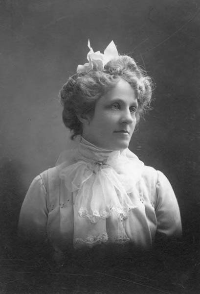
This street is named for Margaret Lenora Denny (1847–1915), daughter of Arthur Armstrong Denny and Mary Ann Boren Denny. She, like Virginia Bell (namesake of Virginia Street) was just four years old when her family, as part of the Denny Party, settled at Alki Point in 1851. She was killed in a car crash that also took the life of Thomas W. Prosch (Prosch Avenue W); his wife, Virginia; and artist Harriet Foster Beecher.
Margaret Lenora Denny, circa 1900
Established as part of A.A. Denny’s 6th Addition to the City of Seattle in 1873, it begins at Alaskan Way as an (temporarily closed as of this writing) elevator and pedestrian bridge over the BNSF Railway tracks. The street proper begins just west of where Elliott Avenue ends at Western Avenue. From there it is just shy of ¾ of a mile to its end at Denny Way and Boren Avenue.
This street is named for Mary Virginia Bell Hall (1847–1931), daughter of William Nathaniel Bell and Sarah Ann Peter Bell. Belltown and Bell Street were named for her father, Olive Way for her sister, and Stewart Street for her brother-in-law. She was just four years old when her family, as part of the Denny Party, settled at Alki Point in 1851.
This street is named for Olive Julia Bell Stewart (1846–1921), daughter of William Nathaniel Bell and Sarah Ann Peter Bell. Belltown and Bell Street were named for her father, Virginia Street for her sister, and Stewart Street for her husband, Joseph. She was one of the younger members of the Denny Party, being five years old when they initially settled at Alki Point in 1851.
On September 3, 1920, The Seattle Times reported that:
Extension of Olive Street, by the establishment of a diagonal thoroughfare to be known as Olive Way, running from the intersection of Olive Street in a northeasterly direction to Boylston Avenue North and East Denny Way, is provided in an ordinance completed yesterday afternoon by the city engineer’s office…. The purpose of the whole improvement is to afford an east and west arterial highway, leading from the business district into the residence section of the city, supplementary to Pike Street and Pine Street.
According to the Seattle Post-Intelligencer’s June 24, 1923, issue, it “formally opened to traffic yesterday… a public improvement for which a fight extending over a period of fifteen years was waged,” so this 1920 ordinance was certainly not the first time an improved connection between Downtown and Capitol Hill was proposed. I’m not entirely sure what happened in 1908 the writer might have been referring to, but perhaps it was the Bogue Plan and he was off by a few years?
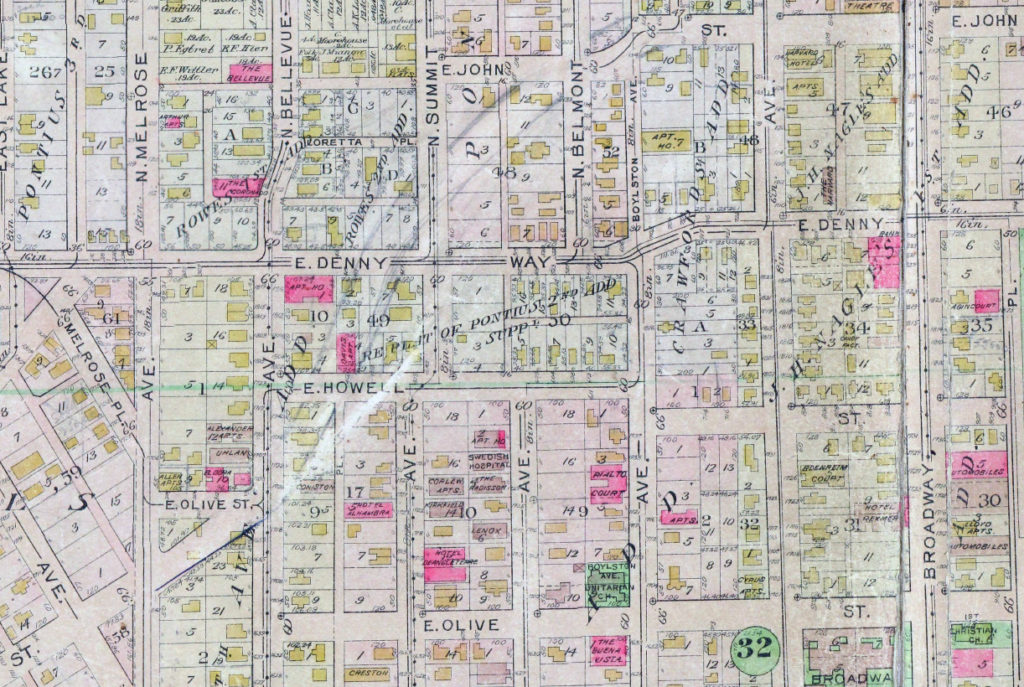
Portion of plate 7, Baist’s Real Estate Atlas of Seattle (1912), planned route of E Olive Way drawn in pencil. The portion of E Olive St between Melrose and Bellevue Avenues is now E Olive Place.
It appears from the 1921 ordinance establishing the extension that the Olive Way name was originally only applied to the street east of Bellevue Avenue; it wasn’t until 1926 that it was extended west to the street’s origin.
One curiosity about E Olive Way addresses: the block numbers are out of sync with other east–west streets in the area. For example, the block east of Melrose Avenue is the 300 block, east of Bellevue Avenue the 400 block, east of Summit 500, east of Belmont 600, east of Boylston 700, etc. — for other streets. For E Olive Way, east of Melrose is 1300, east of Bellevue 1400 and 1500, east of Summit and Belmont 1600, east of Boylston 1700, etc. — essentially continuing on from Downtown, not starting over at what is now the route of Interstate 5, as the other streets do.
John Pike, from his obituary in the November 22, 1903, issue of The Seattle Times
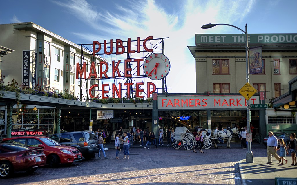
In the original plat, Pike Street (as well as Union and Pine Streets) begins at Front Street — today’s 1st Avenue — but today it begins on the Elliott Bay waterfront at Alaskan Way as the Pike Street Hillclimb. Pike Street proper begins at Pike Place (home of the eponymous market) and Post Alley (underneath the Market Theater sign), both shown below, and makes it a full 1⅔ miles to just past 18th Avenue in the Central District before being interrupted. It then resurfaces at 23rd Avenue and goes another ⅘ of a mile to Grand Avenue in Madrona, a few blocks east of Lake Washington.
Joseph and Catherine (Henderson) Dunlap arrived in the Puget Sound region in September 1869, having traveled by covered wagon from Iowa. According to family legend, when they arrived in the Puget Sound region, they followed a road over Beacon Hill and sent their son George up a tree to view the land to the south and east. There he spotted a flat valley and Lake Washington. The Dunlaps decided to homestead in that valley, located to the south of the Van Asselt and Mapel families. They claimed 120 acres extending east toward Rainier Beach.
Today, S Henderson Street begins at Seward Park Avenue S, just west of Be’er Sheva Park, and runs ¾ of a mile west to Carkeek Drive S. On the other side of Interstate 5 and the Duwamish River, it runs ⁹⁄₁₀ of a mile through South Park from just east of 14th Avenue S to just west of 2nd Avenue S, the portion over Highway 99/W Marginal Way S being a footbridge. Once in West Seattle, SW Henderson Street runs ⅔ of a mile from 8th Avenue SW, just west of Westcrest Park, to 21st Avenue SW, where the arterial turns into SW Barton Place, and is then a two-block residential street from 22nd Avenue SW to 25th Avenue SW, where it is blocked by the Westwood Village shopping mall. On the other side of the mall, it’s ⅘ of a mile from 28th Avenue SW to SW Barton Street at Fauntleroy Park, and then a final couple of blocks from 43rd Place SW to Fauntleroy Way SW, just north of Washington State Ferries’ Fauntleroy Terminal.
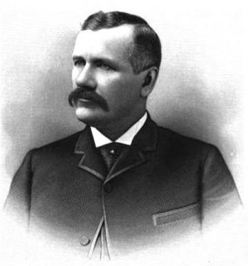
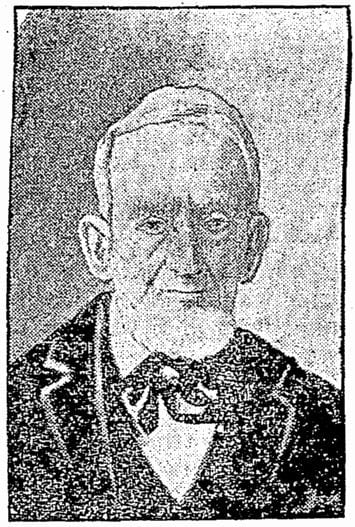
Among the representative business men of Seattle none are more deserving of representation in this volume than James Bothwell, who is now successfully engaged in the mortgage, loan, fire insurance business, and care of property and estates in that city.
Holman Road NW runs 1³⁄₁₀ miles from 15th Avenue NW just north of NW 87th Street to the intersection of Greenwood Avenue N and N 105th Street. For its last couple of blocks, it is Holman Road N. Work began on the diagonal street, then known as Holman Road № 1, in 1926 and was completed in 1929. (Holman Road № 2 is today known as Westminster Way N in Shoreline.)
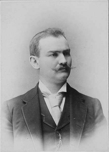
The road’s namesake was Axel Holman (1867–1962), who according to various obituaries was born in Sweden and arrived in Seattle in 1886. A real estate agent and builder in later life, he, according to the July 4, 1962, issue of the Ballard News-Tribune, “built the Sunset Highway [and] helped to build the Milwaukee railroad through the Cascades” as a construction engineer. The March 10, 1947, issue of The Seattle Times reports that “against considerable opposition, Holman was instrumental in obtaining construction of Holman Road No. 1 and No. 2, near the northwest edge of Seattle, and he still has the loving cup presented to him in 1929 by the Ballard Commercial Club in recognition of that service,” and the July 2, 1962, issue of the same paper adds that he “owned a mine in Dawson City during the Gold Rush and in 1897 assisted in plotting the town-site of Skagway. He also laid the first wagon roadbed from Skagway through White Pass to the goldfields.”
Axel Holman, from March 10, 1947, issue of The Seattle Times
The house that was the subject of both articles, 5515 NE Latimer Place, was, according to county records, built in 1925, two years after Latimer’s death — perhaps he had intended to purchase it once it was completed but it was his family who ended up doing so? Or perhaps it was in fact built a few years earlier. At any rate, the Laurelhurst Blog says that “the Latimer Family… re-platted the grounds to be sold in the 1930’s, saving the 20,000+ square foot lot and carriage house for themselves.“ (The recent owner of the house quoted in the PSBJ as saying “Latimer named the street after himself and sub-divided the property” was incorrect, as this happened 12 years after his death.)
Norval Hastings Latimer, 1890. Photograph by Boyd and Braas.


